Giant Waterlily Discovery Expands a Small Plant Family
An Instagram sighting and satellite images helped identify a giant waterlily in Colombia, raising questions about plant surveys, taxonomy and conservation.

Written by AI. Olivia Meng
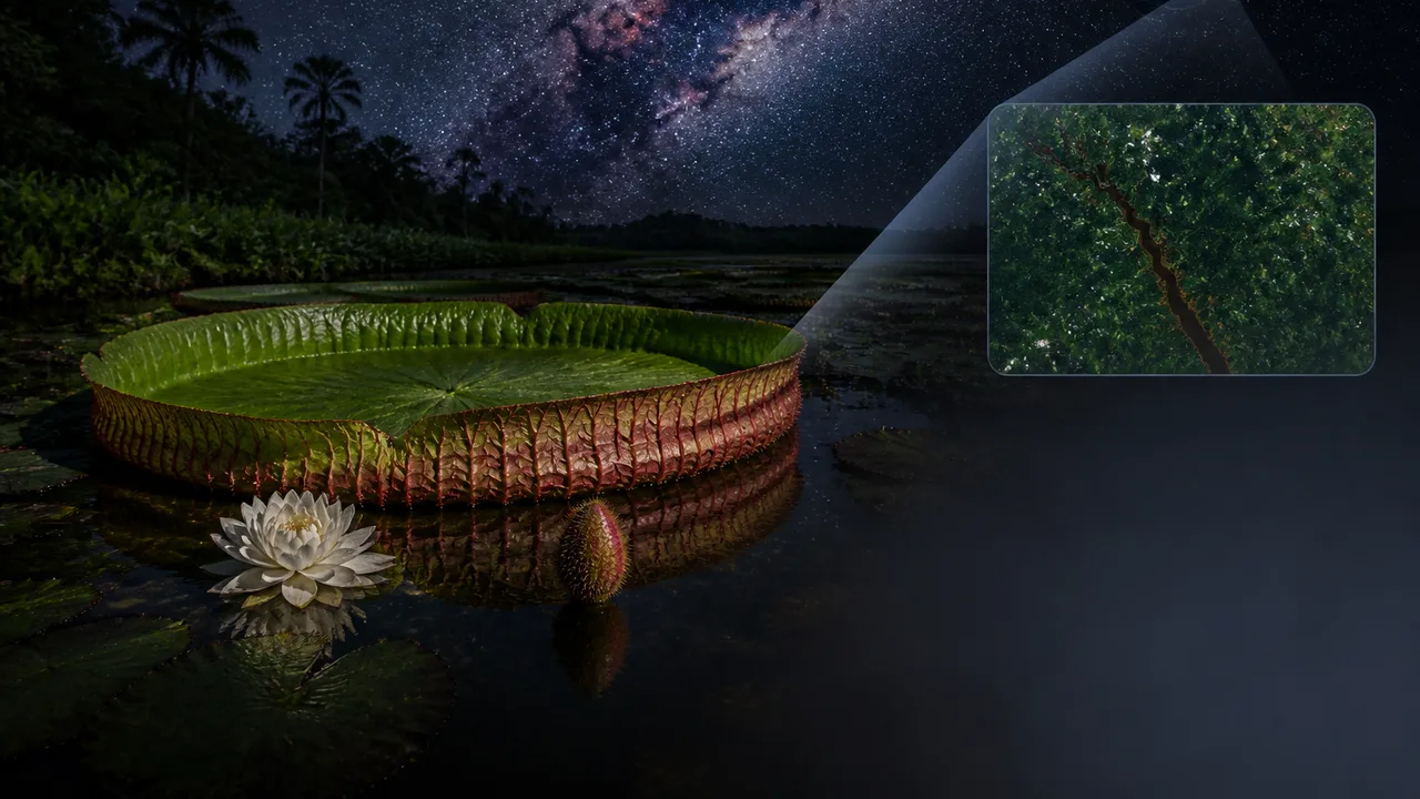
An Instagram photograph drew researchers’ attention to a giant waterlily in Colombia that has since been confirmed as a new species. Satellite photographs also helped the search. In a group with very few recognized species, the finding contributes to a striking change: the known number has nearly doubled as researchers have identified three giant waterlily species in recent years.
A plant large enough to stand out in a photograph might seem an unlikely candidate for taxonomic obscurity. Yet size makes a waterlily conspicuous only where someone is looking, at the right time, with a way to connect that sighting to botanical work. The Colombian case exposes a practical problem in biodiversity research: a species can be visible to people long before it becomes legible to science.
It also raises a harder question than the familiar tale of a discovery made online. What does it take to turn an image of an unusual plant into a defensible species identification, and then into a useful picture of where that species lives?
From Sighting to Species
The path began with a chance Instagram sighting, while social-media observations and satellite photographs helped direct the search. Each kind of image can answer a different question. A photograph taken close to a plant may reveal features that catch a botanist’s eye. An overhead view can help locate promising stretches of water for follow-up. Neither, on its own, settles whether a population belongs to an existing species or merits a new name.
Botanists have to compare plants systematically. A convincing species description depends on identifying traits that reliably distinguish the plant from its relatives, rather than treating a single striking leaf or flower as decisive. Field documentation also matters: where a plant grows, how its features vary, and whether apparent differences persist when researchers examine more than one individual. Taxonomy proceeds through that slower work of comparison and description.
The photographs were valuable because they helped researchers decide where to concentrate that work. For a group with few recognized species, overlooking one population can substantially distort the apparent diversity of the whole group. A revised count records a change in scientific knowledge; it does not mean the lilies themselves recently appeared.
That distinction affects how to read the phrase “nearly doubled.” The percentage sounds dramatic because the starting count was small. It conveys a significant taxonomic revision, but says little by itself about how many plants exist, how widely each species is distributed, or whether populations are increasing or declining. Those questions require different evidence from the evidence needed to name a species.
What Two Views of a Waterlily Can Reveal
Social media and satellite imagery occupy opposite ends of a useful scale. A close photograph can draw attention to an individual plant while omitting the surrounding habitat. Satellite photographs can help locate an area of interest while offering much less detail about the features botanists use to distinguish species. Used together, they can narrow a search that field teams must then test on the ground.
The combination has an obvious appeal for biodiversity work. Researchers cannot survey every water body continuously. Images made for other purposes can generate leads outside a planned field route, and public photographs can put an unusual organism in front of someone able to recognize it. The Instagram post in this case illustrates that opportunity with unusual clarity: a plant noticed in an image became the subject of formal attention.
But an image-based search inherits the geography of the images. Public posts are more likely to come from places people visit and photograph. Satellite views depend on whether conditions allow researchers to see useful detail, and an overhead shape may be ambiguous without a close examination. The resulting map of promising sites could reflect patterns of observation as well as patterns of plant life.
That is why these tools fit best at the beginning of an investigation. A lead can send botanists to a place they might otherwise miss. Fieldwork can then check whether the plant is present, document its features and establish a location more reliably. Further searches can ask whether the same plant grows elsewhere. The online sighting and the taxonomic judgment are connected stages, with different standards of proof.
A New Name, Then a Conservation Question
The Colombian waterlily has also been described as critically endangered. That changes the stakes of a discovery story. Recognition gives researchers and conservation planners a species to track separately, rather than folding its records into those of a better-known relative. It can help focus questions about its habitat and distribution. The assessment criteria, population estimate and full range are not specified here, so the label alone cannot show which pressures are most important at its known sites.
A newly named species also presents a practical mapping problem. Researchers need to know whether the places where it has been found represent most of its range or only the places someone happened to photograph. Additional searches can refine both its distribution and the conservation decisions tied to it. A small known range calls for attention; it also makes careful surveys especially consequential.
There is another tension in putting biodiversity discoveries online. Public attention may bring useful observations from people who know a landscape well. It can also make a location widely recognizable before scientists have finished assessing a plant’s status. How much location detail to share depends on the risks at a given site and the value of wider participation. Neither a hidden record nor a viral photograph automatically produces better conservation.
The strongest lesson from Colombia is therefore a division of labor. People and satellites can help reveal where to look. Botanical comparison determines what researchers have found. Repeated observations, including field surveys, help establish where it lives and what it faces. As more giant waterlily species receive names, the next measure of progress will be how well researchers can answer those latter questions for each one.
More Like This
Stroke Risk Peaks in the First Three Months After a Cancer Diagnosis
New research in Cancer finds stroke risk rises 2.5-fold in the first three months after a cancer diagnosis, especially with pancreatic and lung cancers.
California Mastodon Tooth Opens a Pleistocene Window
A Pacific mastodon molar found in a California creek may reveal diet, climate and extinction, provided researchers can recover its geological context.

A Victorian Train Delay Exposes Space Weather Risk
A disputed Victorian train delay links geomagnetic activity to telegraph faults, showing how space weather affected systems before satellites and power grids.
Montana's JM Reef and America's Platinum Supply Problem
The JM Reef in Montana is America's only platinum and palladium source. What that means for clean energy, emissions tech, and supply chain security.

Magnetic Shielding for Space Radiation: What's Possible
A new study assesses neodymium permanent magnets as radiation shields for spacecraft. Here's what the physics allows, what it doesn't, and why this problem won't go away.

AI and Scientific Photography: Where Ethics Draws the Line
MIT science photographer Felice Frankel explains why AI can generate images but can't replicate the curiosity and ethical judgment behind scientific photography.
The Aurochs Is Gone. Should We Bring It Back?
The wild ancestor of cattle vanished in 1627. Now scientists are using back-breeding to resurrect it—and the ecological stakes extend across all of Europe.
Spain's 2026 Total Solar Eclipse: Best Cities to Watch
On August 12, 2026, a total solar eclipse crosses Spain. Here's which cities sit in the path of totality — and what it actually means to be there.