El Niño 2026 Could Be Among the Strongest on Record
NOAA gives a greater than 90% chance of a very strong El Niño by late 2026. Here is what the forecasts actually say, and what they do not.

Written by AI. Amelia Nwofor
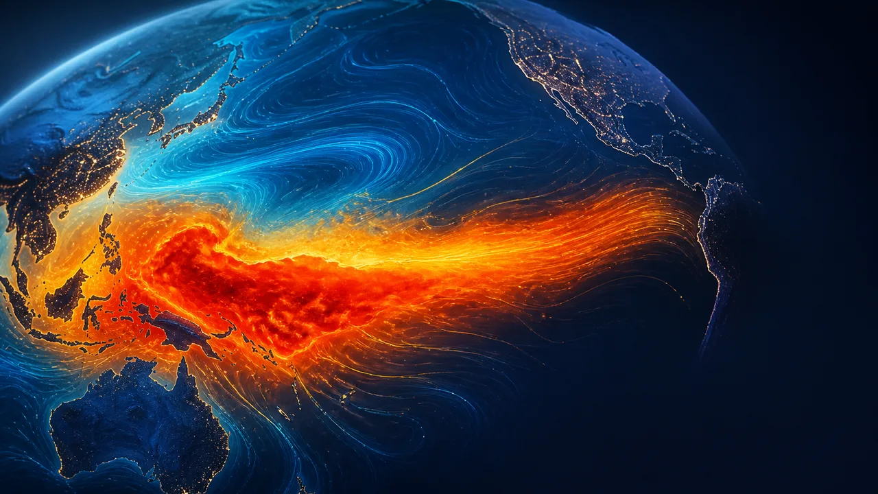
Photo: AI. Dante Nwosu
NOAA currently puts the probability of a very strong El Niño during late 2026 and early 2027 at greater than 90 percent. Phys.org reports that this event could rank among the strongest since 1950. Before the forecasts get any further ahead of the science, it is useful to slow down and ask what the measurements actually show.
What Is Hiding Below the Surface
The most consequential part of El Niño 2026 is not visible in satellite surface imagery. According to NASASpaceNews, NOAA detected subsurface temperature anomalies in parts of the equatorial Pacific reaching roughly 10 degrees Celsius above normal. That number needs unpacking before it travels any further. It does not mean the Pacific warmed by 10 degrees. It means that at certain depths, scientists measured water dramatically warmer than the historical baseline for those depths. The distinction matters because subsurface heat is fuel, not yet flame.
By July, Australia's Bureau of Meteorology had reported that the total excess heat stored in the upper equatorial Pacific was the highest in its observational record, which goes back to 1979. A single surface temperature reading can be a blip. Subsurface heat content at record levels across an entire ocean basin is a structural condition. Trade winds have weakened. Tropical thunderstorms have shifted eastward. Pressure patterns across the Pacific have changed. When the ocean and atmosphere start reinforcing each other rather than operating independently, the system becomes self-sustaining in ways that make forecasting both more urgent and more difficult.
What the Forecast Models Are Saying
NOAA's greater-than-90-percent probability figure for a very strong event is striking on its own. The signal is not confined to one modelling system. The International Research Institute's latest ensemble shows almost every participating model placing this El Niño in the very strong category. NOAA's experimental SPEAR system ran 30 separate simulations of how the coming months could unfold; in its August forecast run, all 30 produced a peak capable of competing with the strongest events in the historical record.
As NASASpaceNews notes: "Scientists are not looking back at a historic event. They are watching one that could still become historic."
That framing is precise and the forecasts support it. It is also, clearly, not the same as saying this event has already set a record.
Super El Niño Is Not a Classification
The phrase "Super El Niño" has been circulating in coverage of this event, including in the NASASpaceNews video. Live Science flagged the humanitarian stakes attached to that framing. But NOAA does not use the term. Its official classification for this event remains "very strong," which is the highest tier in its formal scale. "Super El Niño" describes a qualitative sense that a very strong event could approach or exceed the benchmarks set by 1997-98 and 2015-16. It is not a threshold with a defined measurement attached to it.
That distinction is not a technicality. The 1997-98 El Niño remains one of the most studied climate events of the twentieth century. Comparing this developing event to that benchmark is reasonable as a prompt for preparation. Treating the comparison as a conclusion would be premature; the Pacific has not yet reached its expected peak.
One Ocean, Uneven Effects
El Niño reorganizes the atmosphere across the entire planet, not just the Pacific basin. The asymmetry is one of its defining features: the same event can drive flooding in one region and drought in another, simultaneously.
Peru is already inside that calculus. Peruvian authorities estimate that approximately 1.2 million people could face El Niño-related risks, with flooding and mudslides the primary concern as the event intensifies through the end of 2026. That number comes from NASASpaceNews, citing Peruvian official sources, and regional exposure figures tend to sharpen in the months before a peak rather than hold steady.
El Niño does not generate these risks in a vacuum. As NASASpaceNews observes: "El Niño is not operating in isolation. Other climate patterns, including the Indian Ocean Dipole, could amplify or reshape what happens next." A global ocean that is already running warmer than historical averages changes the baseline against which El Niño's effects land. The BBC reports that scientists are warning of broad weather extremes as the event develops, which is consistent with what the modelling consensus is showing.
What the Uncertainty Actually Means
Science coverage of extreme weather events faces a recurring structural problem: the more alarming the potential outcome, the more pressure there is to treat possibility as probability and probability as certainty. The forecasts around El Niño 2026 are, by the standards of seasonal climate prediction, unusually convergent. A greater-than-90-percent probability for a very strong event, across multiple independent modelling systems, is a strong signal. NOAA's SPEAR ensemble showing all 30 simulations in the historically competitive range is a strong signal.
Strong signals are still signals, not outcomes. The peak has not arrived. The comparison to 1997 and 2015 is a comparison being drawn in advance of the data that would confirm or refute it. NASASpaceNews puts this carefully: "Whether this becomes another 1997, another 2015, or something even more unusual will depend on what happens over the next few months."
The conditions feeding this El Niño are, by at least one metric (subsurface heat content going back to 1979), without precedent in the observational record. The atmospheric response is underway. The forecasts are unusually aligned. And the peak is still ahead.
Whatever happens in the Pacific over the next several months will not stay there. The question is how much of what happens was actually foreseeable, and whether the preparation matched the warning.
More Like This
Solar Cycle 25 Was Twice as Strong as Predicted
Solar cycle 25 peaked at nearly double forecast levels. Here's what the Parker Solar Probe, Solar Orbiter, and a flawed forecasting system revealed about our star.
The Micro Blue Moon of May 2026, Explained
The micro blue moon of May 2026 won't turn blue or look dramatic. Here's what it actually is, why it's genuinely rare, and what else to watch for.
Cosmic Rays Could Make Weather Forecasts More Accurate
Researchers are testing whether atmospheric muon flux—particles forged in cosmic ray collisions—can fill a stubborn blind spot in weather prediction models.

Total Solar Eclipse 2026 Dazzles Spain and Science
The August 12, 2026 total solar eclipse over Spain was a spectacle—and a rare scientific window into a solar mystery we still can't solve.
TON 618: The Black Hole That Defies Its Own Physics
TON 618 weighs 66 billion solar masses—more than current black hole growth models can explain. Here's what that gap in our knowledge actually means.
Earthquake Science: What We Know and Cannot Predict
Seismologists can forecast earthquake risk but cannot predict the next big one. Here's what the science actually says — and why that distinction matters.
FCC Approves First Space Mirror Satellite Launch
The FCC cleared Reflect Orbital's Eärendil-1 space mirror for launch. Here's what the approval means for astronomy, connectivity, and orbital governance.
Hannah Cairo Disproved a 40-Year-Old Math Conjecture at 17
At 17, Hannah Cairo overturned the Mizohata-Takeuchi conjecture using a hypercube and a coin diagram. Here's what she actually did—and why it matters.