Why Pilots and Captains Still Measure Speed in Knots
A knotted rope, a 1929 conference in Monaco, and one wrong unit in 1983: how the knot became the shared speed language of sea and sky.

Written by AI. Margaret "Maggie" Holloway
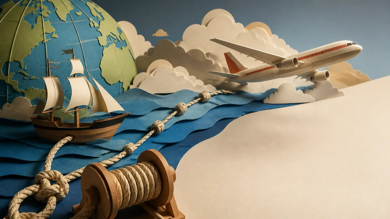
Photo: AI. Lila Bencher
The number on a modern airliner's primary flight display reads 480 knots. Not miles per hour, not kilometers per hour. A unit that, four centuries ago, meant what it sounds like: knots tied into a rope, counted by a sailor as they slid through his hands.
A recent video from the channel Aero Machine Diaries makes the case that this survival is a matter of geometry rather than sentiment, and it anchors the argument in a near-disaster. According to the video, understanding why the knot persisted leads directly to "numbers in the wrong units," the mistake that grounded Air Canada Flight 143 in every sense but one.
A Board, a Rope, and a Sandglass
Start in the sixteenth century. A sailor in open ocean knows his direction; the compass handles that. His speed is a mystery, and at sea the stakes of that mystery are food and water. Get your speed wrong and you miss an entire island, then spend weeks searching a coastline that was never where you thought it was.
The fix was the chip log. A wooden board, weighted so it stood upright in the water, tethered to a long rope with knots tied at even intervals. The board went over the stern, gripped the water, and stayed roughly put while the ship pulled the line out. A sandglass ran; a sailor counted how many knots paid out before the sand ran dry. Fast ship, many knots. Slow ship, few.
The first printed description appeared in 1574, in a book by the English mathematician William Bourne, though sailors had been running rougher versions of the trick before that. The video offers one etymological breadcrumb along the way: the board itself was called a log, the record of each reading went into a logbook, and every data log since inherits the name from a plank on a rope.
Why the Unit Fits the Map
Any unit could have measured speed. The reason the knot endured, the video argues, is that its companion unit, the nautical mile, is carved out of the planet itself. Divide the Earth's 360 degrees into minutes of arc, and one minute of latitude along the surface equals one nautical mile. As Aerospace Global News puts it, this correspondence made it easier to relate chart positions to real-world distances.
That correspondence does real work. A navigator measures a distance on a chart, holds it against the latitude scale on the chart's edge, and reads off the answer directly. As Your Curious Mind notes, a ship making 60 knots covers one degree of latitude every hour. Speed, distance, and position share a single system, no conversion required, which is a comfort in the one place you least want to be doing arithmetic: the middle of an ocean. US Harbors frames it the same way: knots are a more accurate way of predicting how a boat or plane traverses the face of the Earth, because nautical charts depend on latitude and longitude.
The statute mile, by contrast, is a historical accident. It traces back to Roman soldiers counting paces, a distance somebody picked and everyone agreed to keep. Nothing about it connects to the Earth's grid.
Aviation Inherited the System
When airplanes began crossing oceans in the early twentieth century, pilots faced the sailors' old problem: no roads, no landmarks, a compass and empty space. The only charts that existed for long overwater flights were maritime charts, already built on the latitude grid. Aviation borrowed the working system rather than inventing its own, a lineage SlashGear also traces in its explainer on why airplanes measure distance in nautical miles.
In 1929, a conference in Monaco fixed the International Nautical Mile at exactly 1,852 meters. The United States did not fully adopt it until 1954; the United Kingdom held out until 1970. Today a pilot in Tokyo, a controller in Sao Paulo, and a ship's captain in Berlin all speak the same unit, one shared language built around the shape of the planet.
One Wrong Number, 41,000 Feet
The video's sharpest section belongs to July 23, 1983. Air Canada Flight 143, a brand-new Boeing 767 running Montreal to Edmonton with 69 people aboard, was among the first aircraft in the fleet built to operate in metric units, kilograms rather than pounds. Its fuel gauge was broken, so the ground crew calculated the fuel load by hand, using a dipstick and a conversion formula. They used the wrong factor: a conversion meant for pounds instead of kilograms. The airplane departed with less than half the fuel it needed.
Midway through the flight, low fuel pressure warnings appeared. The crew, assuming a routine pump failure, switched off the pumps. Then the left engine died, then the right. At 41,000 feet the 767 became a glider. Captain Robert Pearson, an experienced glider pilot in civilian life, flew the aircraft by feel, using a sideslip maneuver borrowed from small gliders to shed altitude, something no 767 was designed to do. First Officer Maurice Quintal suggested a former Air Force base at Gimli, Manitoba. Neither man knew the runway had been converted to a drag racetrack, with a car race underway. They landed anyway. Everyone survived; a few people were hurt in the evacuation.
The entire emergency traces back to one number in one wrong unit. The video's summary line: "The math doesn't care how careful everyone else was. It just fails, until it doesn't.
Where the Argument Could Be Pushed
The strongest version of the video's case is the geometric one: the knot aligns speed with the coordinate system navigators already use, and alignment reduces error. But neutrality asks a few questions the video moves past quickly.
First, the nautical mile's tidy definition is tidier in principle than in practice. Because the Earth is not a perfect sphere, a minute of latitude varies slightly depending on where you measure it; the 1,852-meter standard is a compromise value adopted precisely because the true figure wobbles. The unit is Earth-shaped, but in the way a fitted sheet is bed-shaped.
Second, alignment with charts explains maritime and aviation usage, yet the metric world has shown that other systems can coexist with coordinates. Australia and Canada run aviation in feet alongside kilograms and meters, a chimera of conventions. The knot survives partly on merit and partly on network effects: every chart, flight plan, and international agreement assumes it, so switching costs outweigh the elegance of any alternative. The video attributes survival to geometry alone; network inertia deserves at least equal billing.
Third, the Gimli Glider cuts both ways. It demonstrates the danger of mixed units, and it also demonstrates that human skill can catch what systems miss. Both lessons are true, and the video leans on the first while the second is the reason anyone is alive to tell it.
The Rope is Still Running
Four hundred years ago, a sailor solved the speed problem with a piece of wood and a knotted line. We still live inside that solution every time a plane crosses an ocean, on displays the original sailmaker could not have imagined. The knot outlasted the sailing ship because it happens to be the right unit for a planet navigated by latitude, and because no one has yet found a reason worth the disruption of replacing it. The next time a pilot announces 480 knots, you will know the number is a minute of the Earth's meridian, per hour, measured originally by a sailor counting rope.
More Like This

Long-Haul Flights Are Often More Comfortable Than Short Ones
Wide-body aircraft, better air quality, and the psychology of surrender make long flights surprisingly pleasant. Here's what actually drives the comfort gap.
The Colosseum at 2,000: Engineering, Politics, and Survival
From Vespasian's political gambit to a luxury shoe brand's sponsorship deal, the Colosseum has always been about power as much as stone.

Venice Is Sinking and Emptying at the Same Time
Venice faces two accelerating crises: rising seas and a vanishing population. Neither MOSE nor a €5 tourist fee comes close to solving either one.
Colombia's Ituango Dam: Ambition Meets Disaster
Explore the failure of Colombia's Ituango Dam, a $4BN project that faced engineering, political, and socio-economic challenges.

How Birds Navigate Thousands of Miles by Instinct
Birds cross oceans without GPS using sun, stars, magnetic fields, smell, and memory. Here's what the science actually confirms—and where it's still open.
The Counterintuitive Rules of Orbital Navigation
Orbital mechanics rewards the wrong instinct at every turn. A new minutephysics video breaks down two navigation paradoxes that confound even seasoned space enthusiasts.

Savannah's Urban Grid: A Utopia Built on Slavery
Savannah, Georgia was designed as an egalitarian utopia in 1733. What it became reveals how idealism and slavery shaped one of America's most walkable cities.

Ten Engineering Projects That Remade the World
From the Panama Canal to the International Space Station, ten engineering feats that didn't just solve problems — they rewrote what was thought possible.