Savannah's Urban Grid: A Utopia Built on Slavery
Savannah, Georgia was designed as an egalitarian utopia in 1733. What it became reveals how idealism and slavery shaped one of America's most walkable cities.

Written by AI. Margaret "Maggie" Holloway
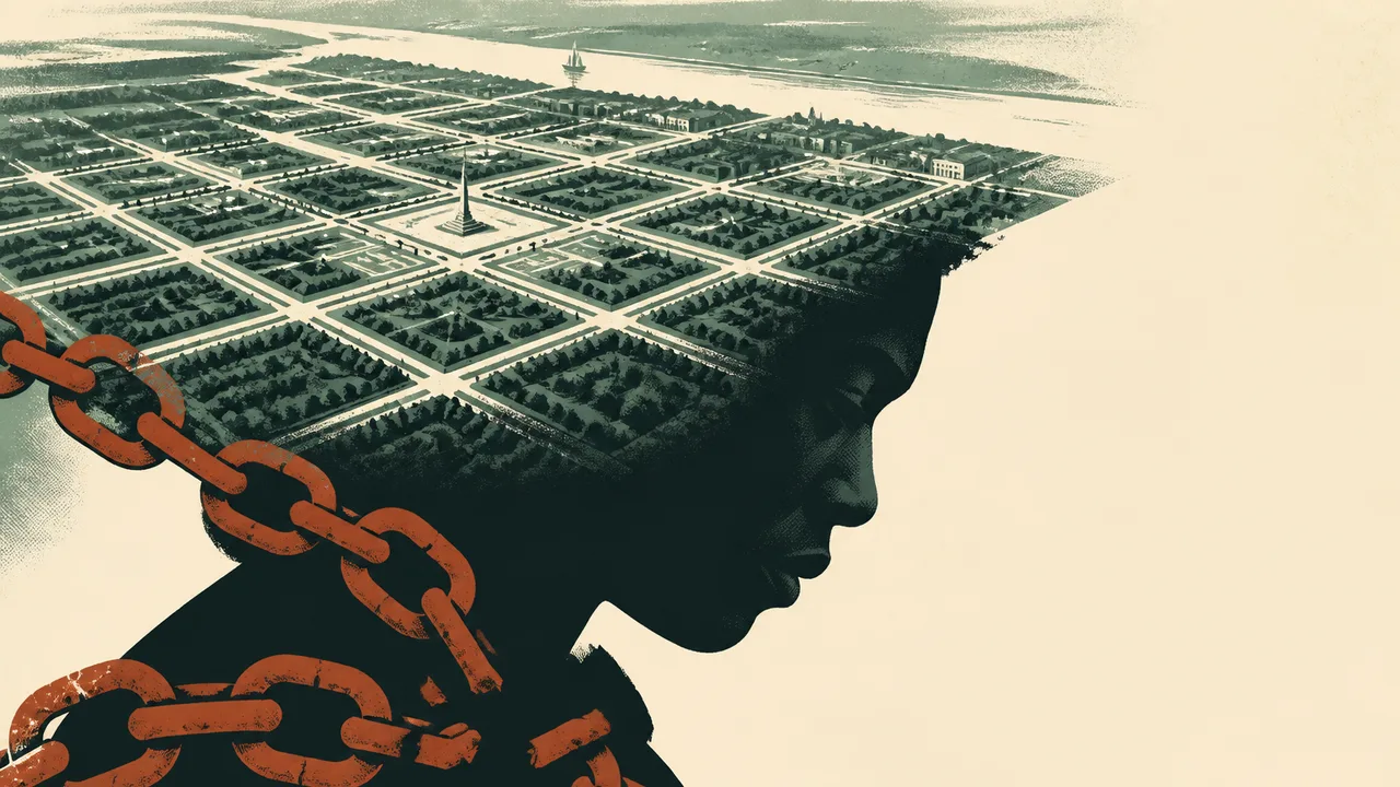
Photo: AI. Mika Sørensen
Pull up a satellite map of Savannah, Georgia and something will nag at you before you can name it. The city doesn't have a downtown in the conventional sense — no cluster of towers marking the center of civic gravity, no single square where the courthouse faces the cathedral across a parking lot. Instead, there's a grid of repeating modules, each anchored by a small public square, tiling outward like a theorem being proved one step at a time. It looks less like an American city than like someone's careful idea of what a city should be.
That's because it was, once. And understanding the distance between that idea and what Savannah actually became is as clarifying a lesson in American urban history as any city on the continent offers.
The Plan That Started as Anti-City
In 1732, a group of wealthy English merchants and politicians called the Georgia Trustees received a royal charter from King George II to establish Britain's thirteenth North American colony. Their leader was James Oglethorpe, and the project he designed for Savannah was, as the YouTube channel Fourth Place puts it in a recent video essay on the city, "pretty much the closest thing to playing God anyone has ever gotten."
The strategic imperative was straightforward: Georgia would serve as a fortified buffer between the British Carolinas and Spanish Florida. But Oglethorpe's ambitions ran further than military geography. He envisioned an egalitarian agrarian society — no central government, no social hierarchy, no industry, no trade economy, and crucially, no slavery. The ban on enslaved labor wasn't purely moral in origin; Spain had developed an effective tactic of emancipating British-held enslaved people and enrolling them as soldiers against their former enslavers, and the Trustees wanted no such vulnerability in their frontier colony.
What Oglethorpe designed to realize this vision was a unit called the ward. Each ward consisted of four residential "tithing blocks" and four "trust blocks" arranged symmetrically around a central square. Tithing blocks were where colonists built their houses — every plot identical in size, none saleable, mortgageable, or rentable, only inheritable by a male heir. Trust blocks were held for public institutions: churches, schools, markets. The squares themselves, far from the ornamental green spaces they appear today, were training grounds for militia. Colonists began laying out Savannah's first four wards in 1733, added two more before the Revolutionary War, and the system — unchanged in its geometry — would eventually generate 24 such squares over the following century.
The key structural insight is this: Oglethorpe didn't try to legislate equality through rules and enforcement after the fact. He tried to make equality physical — to encode it into the land itself, before anyone arrived to corrupt it. There would be no wealthy side of town because the grid would not permit it. No plot could be larger than any other.
It was a remarkable piece of thinking. It was also, almost immediately, under pressure.
The Break in 1750
Subsistence farming in coastal Georgia heat turned out to be brutally hard. The colonists watched neighboring South Carolina's slave economy generate wealth at a pace their egalitarian experiment could not match. By the mid-1740s, they were petitioning Parliament to lift the slavery ban. Oglethorpe resisted, and Parliament held the line — until Oglethorpe himself removed the justification for it. His decisive victory over Spanish forces at the Battle of Bloody Marsh in 1746 eliminated the strategic threat that had motivated the ban in the first place. Four years later, in 1750, slavery was legalized in Georgia.
The Fourth Place video is direct about what followed: "Wealth flooded into the streets of Savannah, Georgia. It was a city brimming with opportunity, mostly opportunity for the rich to get even richer."
The grid did not change. The wards kept expanding — six new squares in the 1790s, more through the early nineteenth century, the final ones established by the 1850s. But the social logic animating the grid had been replaced. Wards sorted by class and race. South Broad Street widened into a boulevard lined with expensive homes. The outer wards, compressed against the original perimeter streets, developed smaller, less desirable lots. The tithing blocks that were meant to house equals began housing the hierarchy that Oglethorpe's plan had been specifically designed to prevent.
The video puts it with appropriate bluntness: "The structure of the streetscape may have looked equal, but after 1750, Savannah's society was anything but."
What remained was the skeleton of an idea without its animating flesh — a spatial egalitarianism inhabited by a profoundly inegalitarian society.
The Accident and Its Costs
Here is where the story gets genuinely strange, and where the Fourth Place framing of Savannah as an "accidentally perfect anti-city" earns its keep.
The walkability that urban planners now study and tourists now photograph — the human-scaled blocks, the distributed public squares, the absence of any single dominant axis — was not preserved because anyone valued it. It persisted largely because Savannah's economy contracted in the late nineteenth and twentieth centuries. Population declined. There wasn't enough development pressure to tear the grid apart. The same economic stagnation that left the city poor kept the demolition crews away.
When preservation finally arrived as policy — the pre-Civil War historic district wasn't designated a national landmark until 1966, and serious zoning protections didn't follow until the 1970s — much of the damage had already been done. The automobile era extracted its toll. Liberty Square and Elbert Square, both laid out in the 1790s and early 1800s, were so thoroughly compromised by road widening and urban renewal that they no longer function as squares at all. Ellis Square, one of the original four from 1733, was filled in entirely during the 1950s to build a parking structure. It was only demolished in 2010.
The irony the video keeps returning to is genuine: the features of Savannah that make it admirable by contemporary urban planning standards — features that planners in cities across America are now spending enormous sums trying to retrofit — were preserved largely by accident, largely through neglect, and were built in the first place not to create great urbanism but to create an agrarian utopia that failed within two decades.
"None of this great urbanism was built to be great urbanism," the video observes. "It just sort of happened."
What the Squares Actually Record
Walk the 24 squares in the order they were established and you're walking through a compressed history of American self-mythology. The early squares honor colonial governors and English political allies. After the Revolutionary War, the naming shifts to American military heroes — generals who died at Bunker Hill and Yorktown and the Siege of Savannah itself. By the 1830s and '40s, the squares commemorate victories in conflicts most Americans today couldn't locate on a timeline: the Battle of Chippawa in the War of 1812, the Battle of Monterey in the Mexican-American War.
There's something telling about the fact that Chippawa Square, named for an 1814 battle fought in what is now Ontario, contains the most prominent statue of Oglethorpe himself — positioned, per the video, to face south toward Florida, still guarding against a Spanish threat that ceased to exist in his lifetime. Monuments, like street grids, outlast the intentions behind them.
What the squares don't prominently commemorate is the labor that built the city after 1750. The enslaved people who worked Savannah's docks and rice plantations, who made the antebellum wealth visible, appear in the landscape as absence — present in the structure of the city (which required their labor to construct and maintain) but absent from its official monuments.
The Question the Grid Leaves Open
Savannah is now growing again after a long contraction, and the Fourth Place video makes a case for how that growth should proceed: fill the tithing blocks with mixed-use housing built in the spirit of the original scale, activate the trust block ground floors with neighborhood businesses, lean into the adaptive reuse of structures that face the squares. Use the grid not as a museum piece but as a living framework.
It's a coherent argument, and the grid probably does offer more workable density potential than most American cities possess. But the video's own history complicates the optimism. The Oglethorpe plan was already a sophisticated, thoughtful framework when it was abandoned in favor of an economy built on human bondage. The lesson isn't that good design protects good values — it's that design and values operate on different tracks entirely, and a city can have one without the other for a very long time.
Savannah's squares are genuinely pleasant to sit in. The live oaks, the proportions, the way the blocks break pedestrian distance into manageable segments — these are real qualities. They also exist because of, not despite, the historical choices that betrayed the plan that produced them. How a city reconciles those two facts — the beauty and the foundation — is not a question urban planning can answer.
More Like This
How Times Square Became a Billboard for Itself
Times Square's wall-to-wall advertising wasn't inevitable. It was built by specific people, specific decisions, and one very consequential zoning law.

Unveiling Rome's Gladiator Underworld
Explore the hidden world beneath ancient Rome's arenas, unveiling gladiator training, underground tunnels, and cultural practices.

Jackie Kennedy and Lee Radziwill's Bitter Lifelong Feud
The feud between Jackie Kennedy and her sister Lee ran deeper than jealousy. A look at the betrayals—plural—that made it permanent.
The Anaconda Plan Was Right. People Paid for It.
Winfield Scott's Anaconda Plan was strategically vindicated — but the years it took to work were paid for in hunger, death, and bondage by ordinary people.

Learning Local Culture Without Setting Foot in a Museum
From grocery stores to barbershops, Mark Wolters argues everyday spaces teach travelers more about a culture than any museum ever could. He makes a strong case.

How Google Maps Calculates Your Route
Google Maps answers in seconds, but nobody outside its private engineering teams knows exactly how. Here's what the research community can piece together.
Ten Engineering Projects That Remade the World
From the Panama Canal to the International Space Station, ten engineering feats that didn't just solve problems — they rewrote what was thought possible.

The Invisible Inventions That Built Modern Life
From flush toilets to undersea fiber cables, the inventions that most shaped modern civilization are the ones we've stopped noticing entirely.