Why All Roads Did Not Actually Lead to Ancient Rome
A network analysis finds Rome peripheral by road but central by sea, government and myth, showing how infrastructure, geography and power diverge.

Written by AI. Margaret "Maggie" Holloway
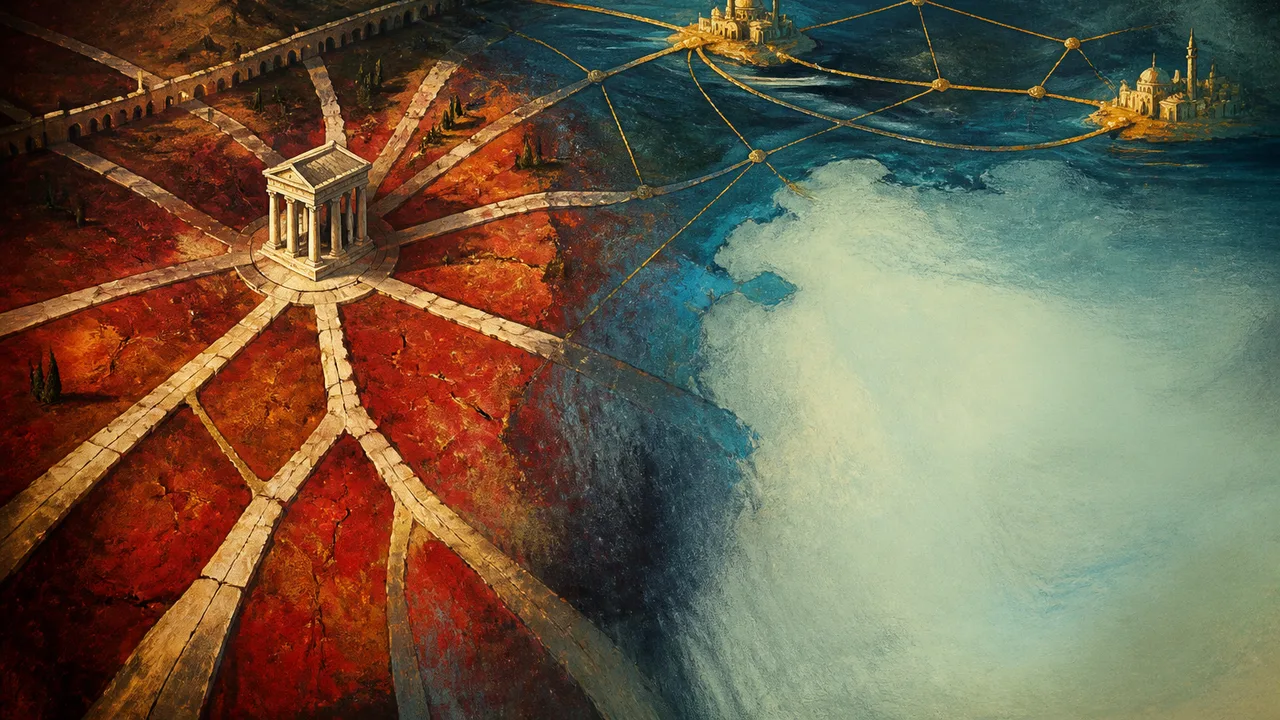
Rome occupied the political heart of its empire while sitting halfway down what one researcher calls an “appendix” of its road network.
That awkward geography is the finding beneath a new network analysis of Roman roads. Using a digital atlas containing nearly 300,000 kilometers, or 186,000 miles, of routes, researchers examined how roads connected cities across Europe, North Africa, the Middle East and western Asia. Rome did not emerge as the land network’s indispensable junction. Antioch, Ancyra, Byzantium and Corinth were better situated for overland travel.
The result gives an old proverb a useful beating, but it also reveals something more durable than a busted cliché. A city can command a political system, dominate its symbolic map and remain peripheral within one of the physical networks that sustains it. Rome had several kinds of centrality. Roads were only one of them.
A Capital Halfway Down the Peninsula
At the Roman Empire’s greatest extent in AD 117, it covered about 5.5 million square kilometers, from Britain toward the Sahara and across three continents. On a political map, Rome appears to hold this expanse together because the empire carries its name and the capital supplies the map’s organizing idea. Geography draws another picture.
Tom Brughmans, a co-author of the analysis, described the Italian Peninsula as an appendix extending into the Mediterranean, with Rome halfway down it. The study’s most important intermediary land route bypassed the capital. It followed the North African and Levantine coasts, passed Antioch and the vicinity of Ancyra, crossed into Europe at Constantinople, continued through the Po Valley and Milan, and then entered France.
Even within Italy, the most central route ran along the Adriatic side of the peninsula rather than through Rome. This makes geographical sense. A traveler moving between distant parts of a continental network benefits from junctions that connect regions without requiring a long trip down a peninsula and back again. Rome’s location favored access to the Mediterranean, while its position weakened its usefulness as an overland bridge between provinces.
Provincial capitals consequently worked as regional crossroads. Major public and military roads carried goods, people, official messages and ideas through those local hubs. The empire’s road system resembled a collection of connected centers more than a wheel whose every spoke terminated at one imperial doorstep.
That distinction changes how the infrastructure should be read. Roads supported Roman power without reproducing its hierarchy on the ground. Administration pointed toward Rome; much everyday movement passed through places such as Corinth and Ancyra. The capital could sit at the top of the governing system while other cities did more of the network’s connective work.
A Medieval Sentence with an Imperial Ancestor
The familiar proverb arrived long after the roads themselves. Its earliest cited written appearance comes from the French poet Alain de Lille in 1175: “Mille viae ducunt homines per saecula Romam,” translated as “A thousand roads lead men forever to Rome.” The phrase was medieval, and its destination carried religious and symbolic force as well as memories of empire.
Yet the image had an ancient ancestor. In 20 BC, Augustus placed a golden milestone in the Roman Forum as a symbolic origin point for the empire’s principal roads. The object presented the capital as the place from which distance and authority could be imagined. Whether every important journey physically passed through Rome was beside the political purpose. The stone made Rome the conceptual beginning of the system.
That helps explain how a geographical overstatement could survive. The proverb compressed administrative authority, maritime access, monumental display and roads into one memorable picture. Its modern figurative meaning, that several methods can produce the same result, loosened it further from transport geography.
The new analysis therefore corrects a medieval formulation rather than exposing Roman road builders as incompetent map readers. Rome’s rulers could depict their city at the center because government operated from it and imperial communications served that government. A symbolic center answers the question “Who commands?” A network center answers “Where do the most consequential routes pass?” Those questions can point to different stones on the map.
Constantinople Offers the Revealing Comparison
Byzantium, later Constantinople and now Istanbul, performed better in the analysis of land connections. The central route crossed between Asia and Europe there, placing the city along a path linking eastern territories with the Balkans, northern Italy and lands farther west.
In 324, Constantine I moved the imperial capital from Rome to Constantinople for strategic and economic reasons. That historical shift aligned political authority more closely with the road geography identified by the researchers. It does not establish that road centrality caused Constantine’s decision. The evidence presented here supports the broader strategic and economic explanation, while the network analysis shows why Constantinople’s location offered advantages Rome lacked.
The comparison also has limits. Both capitals benefited from political investment, but their geographical positions differed. Constantinople lay on the analyzed overland corridor between regions; Rome occupied the western side of central Italy, down the peninsula from continental Europe. Government could elevate either city, but it could not move the Italian landmass.
The roads themselves carried the same negotiation between ambition and terrain. Roman routes were often straight across accommodating lowlands, but mountains required bends. Modern highways can cut, tunnel and grade the landscape more aggressively, allowing straighter routes designed for cars. Around 90 percent of Roman roads nevertheless had gradients that could accommodate animal-drawn carts and wagons, including routes through the Alps, according to the study’s reported findings. Roman engineers did not ignore topography; they built mobility through it with the tools, labor and vehicles available to them.
What This Map Can and Cannot Settle
Itiner-e was assembled from historical sources, excavation reports, satellite imagery and earlier datasets. Its scale permits questions that scattered surviving pavements cannot answer alone, but the map contains substantial uncertainty. Only 2.7 percent of its road locations are classified as known with certainty. About 90 percent are less precisely located, while roughly 7 percent are hypothetical.
Francesca Fulminante of the University of Bristol, who did not participate in the analysis, characterized the work as a mathematical confirmation of patterns previously described in broader terms. She also noted that uneven accuracy across such a large dataset does not erase the results. That assessment places the study’s contribution in proportion: it gives continental scale and numerical structure to an argument, rather than summoning an unknown Roman world from scratch.
Time presents another complication. Ray Laurence of Macquarie University observed that the road network developed over 600 years, while the analysis gives limited attention to changes within that long period. A road system inherited from conquered territories, expanded under successive rulers and altered across centuries cannot represent every Roman traveler’s world at once. The findings support a large-scale structural picture, not the claim that Rome held the same network position in every decade.
Water supplies the largest missing layer. The analysis covers roads, while Rome’s place near the center of the Mediterranean connected it to major shipping lanes and to Ostia at the Tiber’s mouth. The researchers plan to incorporate sea and river routes in future work. Until then, Rome’s overall transport centrality remains unresolved.
That limitation sharpens the lesson rather than dissolving it. Roads, ports, rivers, government offices and monuments each produce their own map of importance. When those maps are stacked together, a capital can look inevitable. Separate them, and the supposed center begins to move. All roads did not lead to Rome, but enough power, cargo and imagination did to make generations believe they had.
More Like This
The Medici and the Borgia: Power, Banking, and Renaissance Italy
The Medici-Borgia rivalry was no simple feud. A look at how banking, papal power, marriage, and armies shaped Renaissance Italy's contested politics.
How Linguists Reconstruct the Sounds of Ancient Latin
No recordings survive from ancient Rome, yet linguists can reconstruct how Latin actually sounded. Here is the methodology behind that remarkable claim.
Romania Travel: What Visitors Love and Struggle With
From Carpathian forests to chaotic mountain roads, Romania rewards patient travelers. Here's an honest look at what works and what doesn't.
The Herodium Ring and the Machinery of Roman Rule
A copper ring from Herodium, its unusual Greek O, and a cautious Pilate link reveal the workers and unresolved readings behind Roman rule in ancient Judaea.
Baiae: The Sunken Pleasure City of Ancient Rome
Beneath the Bay of Naples lie the ruins of Baiae, Rome's most scandalous resort. New 3D scanning reveals what volcanic geology buried and the sea swallowed.
Homer's Odyssey and Mycenaean Religion: Fact vs. Myth
Homer set the Odyssey in the Bronze Age but wrote it 500 years later. How accurate is his religion? Linear B tablets reveal a startling gap.

Ten Scientific Discoveries Nobody Saw Coming
From Fleming's contaminated petri dish to Hubble's blurry mirror, accidental observations have repeatedly reshaped what we know about life and the cosmos.