Mesolithic Goldcliff: Racing to Save Stone Age Footprints
At Goldcliff in South Wales, archaeologists have a two-hour daily window to rescue Mesolithic footprints and tools from the rising Severn Estuary.

Written by AI. Helen Papadopoulos
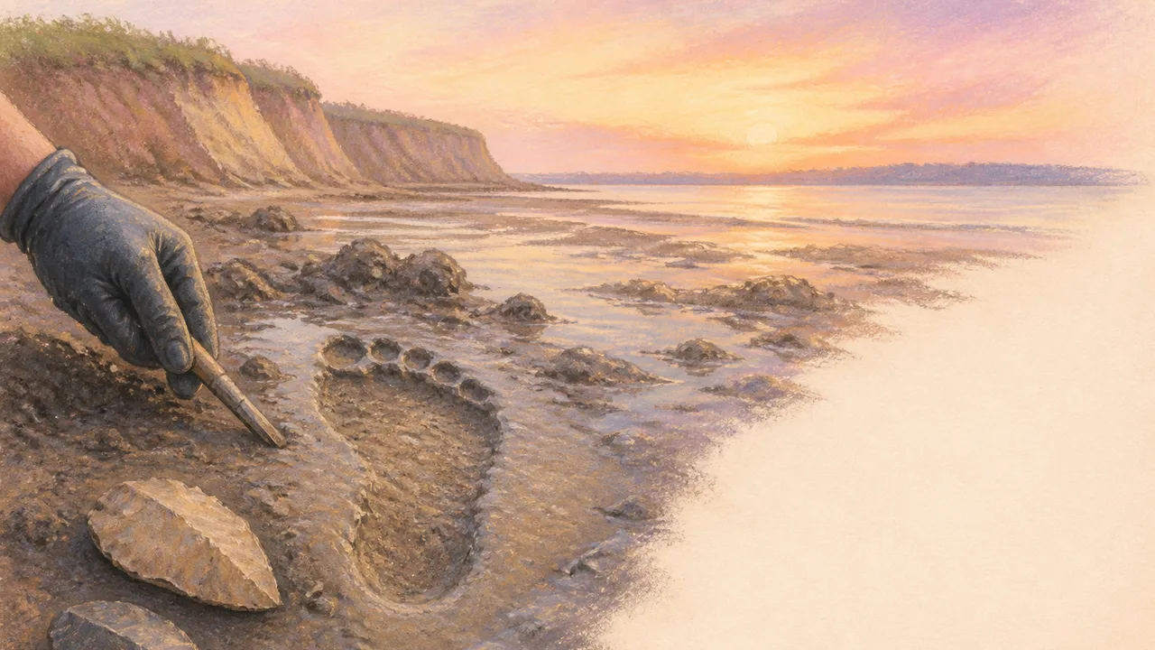
Photo: AI. Aiyana Stone
The tide at Goldcliff doesn't negotiate. It comes in on schedule, it doesn't care what you've found, and it has been slowly eating a Mesolithic campsite that hunter-gatherers used for winter shelter some 7,500 years ago. The archaeologists working there get roughly two hours of access to the foreshore each day. After that, the Severn Estuary reclaims everything.
That pressure — institutional, geological, climatic — is the through-line of a recent documentary following a three-day rescue excavation at this stretch of South Wales coastline. But the more interesting tension isn't between the archaeologists and the tide. It's between what can actually be known about people who left almost nothing behind, and how urgently we need to know it before the evidence disappears.
A Site That Shouldn't Exist
Mesolithic sites are, as one contributor puts it, "as rare as hens' teeth." The period spans roughly 6,000 years — from the end of the last Ice Age around 9,500 BC to the arrival of farming communities — and yet the archaeological record for it is almost insultingly thin. These were mobile people. They carried what they needed. They didn't build permanent structures that leave identifiable footprints in the soil, didn't farm in ways that reorganize the landscape, didn't accumulate the kind of debris that later civilizations left for us to sort through.
Which is exactly what makes Goldcliff so significant. Waterlogged foreshore conditions preserved what dry land would have destroyed: sealed archaeological layers, organic material, actual footprints in estuary mud. Professor Martin Bell of Reading University, who has spent 13 years excavating 25 separate sites on this foreshore, describes it simply: "the waterlogged deposits, the sealed archaeological sites, quite unlike the ones you get on dry land."
The bitter irony is that the same geological process now threatening the site — rising sea levels and increased tidal erosion — is also what exposed it in the first place. The sea uncovered it; the sea is now destroying it. The team has perhaps a year or two before what remains is gone.
What You Can Learn from a Flint the Size of a Fingernail
The dig's central target is a 15-square-meter patch of foreshore called Trench B. Given the tidal window, the team's solution is methodical and slightly vertiginous in concept: map the trench into one-meter squares, cut those squares into blocks, physically lift the entire section off the beach, transport it to a dry tent, and then reassemble and excavate it at leisure. It is, as someone observes, "like cake making" — if cake making involved quicksand and the constant threat of losing a boot to the estuary mud.
The finds this approach yields are not cinematic. The first significant discovery after eight hours of work is a microlith: a fragment of retouched flint smaller than a postage stamp. The retouching is the key detail. This piece was resharpened, which means it was valuable enough to repair rather than discard — which means the person carrying it had both the skill and the intention. As the excavation team explains, microliths functioned as modular components: "you can literally pull it out and replace it with an exactly similar component." The original Swiss Army knife, fabricated from river flint 7,500 years ago.
The absence of certain byproducts matters too. Microlith production typically generates small waste fragments — notched ends that snap off during the knapping process. At Goldcliff, those byproducts are largely absent, suggesting the tool wasn't made on site. It was brought in ready-hafted, used, broken, and discarded. That single inference traces a moment of travel, preparation, and loss.
177 Footprints and What They Don't Tell Us
The documentary's most affecting material comes from a different part of the foreshore, where postgraduate researcher Rachel Scales has been painstakingly uncovering human footprints. Not casts, not impressions recreated for display — actual Mesolithic footprints, 177 of them, preserved under a sealed layer of peat that has been independently dated. They are unmistakably human in form, and some of them are small enough to belong to children.
The stratigraphic case for their age is solid. But what they mean is another question, and it's one the documentary handles with appropriate care. The team deploys experimental archaeology to help: walking across similar salt marsh conditions with adult and child volunteers, under the guidance of footprint forensics expert Professor Robin Crompton, to generate comparative data. The results are genuinely useful — differences in stride length and pressure distribution allow researchers to distinguish adult from child prints, and potentially to infer whether someone was carrying a load, moving fast, or simply wandering.
What the experimental work also revealed was a narrow window of preservation. "Those Stone Age footprints can't have taken much longer than about 15 seconds to produce," Crompton notes, "because any longer and you start churning up your footsteps." The footprints at Goldcliff represent a moment — not a period, not a season, not a practice. Fifteen seconds of people walking across mud, preserved for 7,500 years. Looking at the children's trails, Rachel Scales is fairly direct about her interpretation: "I think they were just out really enjoying themselves."
That's not a scientifically testable claim. It's also not nothing.
The Seasonal Logic
The picture that accumulates across three days of excavation is less a portrait of daily life than a calendar. Charred raspberry seeds, elderberry seeds, and hazelnut shells — all dateable to late summer and autumn — suggest that Goldcliff was a seasonal camp, occupied during the colder months. The coastal location between the mouths of two rivers, the Usk and the Wye, gave the island-community access to fish, wildfowl, marine resources, and the raw flint they needed for toolmaking. When spring came, the evidence suggests they moved inland and upriver, following red deer herds into the uplands.
The presence of aurochs remains — teeth twice the size of modern cattle, from animals that stood six feet at the shoulder — indicates that hunting at Goldcliff wasn't limited to small game. It also implies coordination, strategy, and probably dogs. An aurochs wasn't killed outright by a single barbed microlith projectile. It was wounded, tracked, and finished. The toolkit found at the site supports exactly that kind of multistage hunting operation: cutting edges, piercing tools, scrapers for processing hides.
What this amounts to is a picture of people who knew their landscape with extraordinary precision — who tracked seasonal resources across a broad territory, maintained a sophisticated modular toolkit that could be repaired and repurposed, and structured their lives around an annual migration that connected coast to upland and back again. The word "primitive" has no useful application here.
What Gets Lost When We Don't Move Fast Enough
The excavation team salvages five square meters of Trench B. They had hoped for fifteen. The Severn takes the rest.
There's a methodological argument woven through the documentary that deserves acknowledgment: at what point does the urgency of rescue override the precision of standard excavation? One team member proposes moving faster through the clay blocks, arguing that "everything we do is a bonus, cuz the Severn will have it if we don't get it." A cement mixer is deployed to speed up the sieving of spoil. These are genuine compromises, made under genuine pressure, and the documentary doesn't pretend otherwise.
It's an argument that preservation practitioners in multiple fields will recognize. Imperfect record is better than no record. Five meters rescued imprecisely is better than fifteen meters consumed by salt water. The question of how much methodological compromise is acceptable — and who decides — is one archaeology is going to keep confronting as climate change accelerates coastal erosion at sites like Goldcliff around the world.
Professor Bell has been on this foreshore for thirteen years. The site he's been working will continue to shrink. What the team took away in those 80 lifted blocks of estuary mud is now the permanent record — seeds, bones, microliths, an aurochs footprint found in the very last block processed.
What's still out there, beneath the tidal water, probably won't wait for another expedition.
More Like This
WW1 Trench Life: What the Western Front Was Really Like
From Pals' Battalions to the Vickers gun, a new documentary unpacks the grim machinery of survival on the WW1 Western Front in unflinching detail.
Chapel Head: Time Team Digs the Cambridgeshire Fens
Time Team's "Beacon on the Fens" investigates Chapel Head in Cambridgeshire, uncovering a medieval chapel, Saxon pottery, and layers of prehistoric occupation.
Baiae: The Sunken Pleasure City of Ancient Rome
Beneath the Bay of Naples lie the ruins of Baiae, Rome's most scandalous resort. New 3D scanning reveals what volcanic geology buried and the sea swallowed.
Venice Is Sinking and Emptying at the Same Time
Venice faces two accelerating crises: rising seas and a vanishing population. Neither MOSE nor a €5 tourist fee comes close to solving either one.
Roman Altar Surfaces from a Shrinking Danube
Record-low Danube water levels in Hungary have exposed a Roman altar to Jupiter, WWII munitions, and mammoth bones—history unlocked by climate crisis.

Waco Siege: Ancient Echoes in Modern Tragedy
Explore the 1993 Waco siege through the lens of ancient cult dynamics and modern law enforcement challenges.

Stoicism as a Political Philosophy, Not a Retreat
Massimo Pigliucci argues Stoicism's dichotomy of control isn't passive resignation—it's a framework for smarter, more durable political engagement.

Pandemics That Brought Down Ancient Civilizations
From Cahokia to Constantinople, ancient DNA is rewriting how civilizations fell. Disease was often the hidden accelerant history forgot to record.