How Tectonic Forces Shaped the European Continent
From 3-billion-year-old Norwegian rocks to the Alps still rising today, Europe's geological story is wilder than any human history we know.

Written by AI. Amelia Nwofor
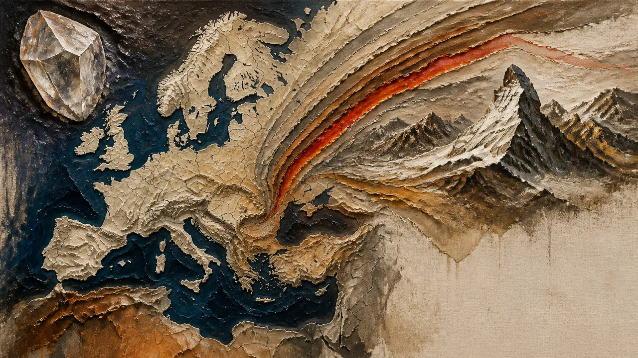
Photo: AI. Saskia Aaltonen
Pick up a handful of dirt anywhere in Europe and you're holding the compressed memory of vanished oceans, ancient collisions, and tropical forests that decomposed into the coal seams that powered the Industrial Revolution. Europe as a political entity is barely centuries old. Europe as a geological entity is a story spanning billions of years — and it's still mid-sentence. 🧬
The documentary Voyage of the Continents (Season 1, Episode 1), directed by Christopher Hooke, takes that premise seriously. Rather than gesturing vaguely at deep time, it grounds the story in specific rocks, specific researchers, and specific places where the past is still legible to anyone who knows how to read it. The result is a geography lesson that quietly dismantles the idea that Europe has a fixed, coherent identity — geological or otherwise.
The Oldest Room in the House
The documentary opens in Kirkenes, in northern Norway, where geologist and prospector Pavl searches for kimberlite — a type of ancient lava that can carry diamonds from deep in the Earth's mantle up to the surface. He doesn't find diamonds. But what he does find is more interesting to anyone who isn't trying to get rich: a zircon crystal close to 4 billion years old, embedded in rocks that are among the oldest formations in Europe.
The significance? As the documentary explains, this pushes back Europe's origins further than previously established estimates. The Scandinavian shield — that ancient, stable core of northern Europe — turns out to be an even older foundation than scientists had thought. Pavl describes diamonds as "a beautiful record of the early Earth, what was going on 3.5, 3 billion years ago." He came looking for treasure. He found a timestamp.
The kimberlite search itself is worth pausing on. The documentary is candid about how the process works — or mostly doesn't. Lab technicians analyzing the samples note that kimberlites can sit right next to each other, with one yielding diamonds and the other containing none at all. "The sampling is actually quite by chance," one technician explains. "There's no rule about which kimberlite is going to be diamondiferous and which is not." This is geology as humbling enterprise, not triumphant discovery — a frame the documentary maintains throughout.
Scotland Is Partly American Crust
Around 420 million years ago, two ancient landmasses — Baltica (a proto-Europe) and Laurentia (a proto-North America) — collided. The result was the Caledonian mountain range, once likely as dramatic as the Himalayas. What remains of it is visible in the Scottish Highlands, which is where Rob Butler of the University of Aberdeen takes the documentary's cameras to explain one of geology's stranger facts: some of Scotland is literally American crust.
Butler reads the rock layers at Loch Glencoul like a text. The normal rule — younger rocks on top of older ones — is violated in spectacular fashion here. Laurentian gneisses, 3 billion years old, sit on top of quartz sandstones half a billion years old. Older on younger. The explanation is the Moine Thrust: a fault that moved enormous sheets of rock approximately 100 km horizontally over millions of years, heaving pieces of the Laurentian plate across what is now Scotland.
"Collision between continents is about one of the most dramatic things that can happen in tectonics," Butler says. "But the trouble with ancient mountain ranges is they're gone. So we need to look for the geological clues for how those mountain ranges formed."
The Moine Thrust Belt, discovered in the 19th century and stretching for close to 200 km, is where the front line of that collision is still visible at the surface. It's the kind of site that makes you reconsider the ground you're standing on — anywhere.
Europe Was Tropical, and Coal Remembers That
The collision of the supercontinent Gondwana with Laurasia around 300 million years ago created the Hercinian belt — a vast mountain chain that once ran across Europe from Poland through Germany, France, and Portugal, and extended into what is now North America. At its peak, the documentary says, it reached elevations comparable to the Himalayas. Almost nothing of it is visible now except granite outcrops in Brittany, the exposed roots of mountains long since eroded to nothing.
But the forests that grew in its shadow left their own record. Jean Gautier, professor emeritus at France's National Center for Scientific Research, describes what a walk through southern France would have looked like 300 million years ago: no pines, no walnut trees — instead giant lycopsid trees called Sigillaria, ferns, and plant forms that no longer exist anywhere. Europe sat near the equator then. The climate was tropical. Plants thrived in ways they can't today in the same latitudes.
When those forests died, bacteria were slow to break them down — the documentary attributes this to the novelty of lignin-rich wood, which decomposition machinery hadn't yet caught up with. The organic material accumulated, compressed, and became coal. The seams of pit coal that fueled centuries of European industry are, in this light, a direct inheritance of tectonic positioning and biological timing.
The Alps Are Made of Africa
The most counterintuitive section of the documentary concerns the Alps, and it involves a mountain you've probably seen on a chocolate box.
When a fragment of the African plate broke off and was pushed northward toward Europe roughly 100 million years ago — eventually becoming the landmasses we now call Italy and Croatia — the collision buckled and folded the ocean floor between them, lifting it skyward. What had been seafloor sitting 3,000 meters below water is now high in the Alps.
Geologist Michele Marthaler, filming near Zermatt in the Swiss Alps, lays out the paradox clearly. The area contains three distinct geological identities in close proximity: ancient European continental rock in the Monte Rosa massif; oceanic crust from what was once the Tethys Sea; and, sitting on top of all of it, the Matterhorn — a chunk of continental crust that originated in Africa.
"People can come to this one small location," Marthaler says, "and visit Europe, the sea right here, and over there Africa."
The Alps, in other words, are not simply a European mountain range. They are the physical record of a continental collision, still ongoing. Africa continues to press northward. The Alps continue to rise, at rates too slow to feel but fast enough to measure.
Chalk Cliffs Are a Graveyard You Can Hold in Your Hand
One of the documentary's most satisfying sequences involves the White Cliffs of Dover, which turn out to be made of something almost absurdly small. Geochemist Nikolola Tribovillard, specializing in ancient oceans, studies coccoliths — the limestone armor of single-celled algae, each one just a few millionths of a meter across. Billions of these organisms lived and died in the Cretaceous seas that covered northern Europe, and their shells piled up on the seafloor hundreds of meters deep.
When Pangea broke apart, expanding mid-ocean ridges displaced enormous volumes of water, raising sea levels — Tribovillard compares it to getting into a bathtub — possibly by as much as 200 meters above current levels. Eventually the seas withdrew, leaving chalk formations stranded well above the waterline. The White Cliffs of Dover are, at their most literal, a cemetery of microscopic algae elevated by the physics of plate tectonics. That's not a metaphor. That's just what they are.
A Continent Still Being Written
The documentary moves efficiently through billions of years without ever becoming a lecture — partly because it keeps returning to the same central observation: the evidence is here, accessible, physical, present. Dinosaur proto-footprints preserved in what is now the Swiss Alps at an altitude of 2,400 meters. Pillow lava from ancient underwater volcanic eruptions on the flanks of mountains. Radiolarian fossils in red rock that date the sediment to the Jurassic ocean floor, now thousands of meters above sea level.
Each site is a palimpsest — a surface written over and over, with the old text still visible underneath if you know the alphabet.
What the documentary leaves open, and what makes it worth sitting with, is the question of future geography. Africa is still moving north. The Mediterranean is slowly narrowing. The forces that assembled and reassembled Europe over billions of years haven't paused. The continent its 51 countries call home is not a finished product.
Which raises a question that geology poses better than politics ever could: what do we actually mean when we say "Europe"?
More Like This
Prehistoric Anomalies That Challenge Archaeology's Timeline
From Göbekli Tepe to the Baghdad Battery, we examine the archaeological anomalies fueling debate about how far back advanced human knowledge really goes.
The Deeper Geometry Behind the Pythagorean Theorem
Explore why the Pythagorean Theorem appears in unexpected places, from geometry to relativity.
Unknown Humans Are Hidden Inside Your DNA
New genetics research reveals only 1.5–7% of our DNA is uniquely human. The rest? Ancient relatives—including species we haven't even named yet.
The Teutonic Knights Built a Medieval Corporate State
The Teutonic Knights weren't holy warriors — they were medieval operators who built a sovereign state on contract law, grain prices, and systematic erasure of native Prussian culture.
Why Light Beams Seem to End: Physics Explained
Discover why searchlight beams appear to stop and how physics and atmospheric conditions contribute to this phenomenon.
Donald Hoffman: Evolution Hid Reality From Us
Cognitive scientist Donald Hoffman argues on StarTalk that evolution gave us a VR headset, not a window—and the math behind Darwin backs him up.
Why Physics Still Cannot Explain What Time Actually Is
Philosopher Simon Saunders tells Curt Jaimungal why time remains physics' most poorly understood concept—and why our models may never capture its felt reality.
Neutrinos, Oscillation, and the Matter-Antimatter Mystery
Particle physicist Kirsty Duffy explains neutrino oscillation, what it broke in the Standard Model, and why DUNE may finally answer why matter exists at all.