How El Niño Raises Fire Risk Across the Amazon Basin
El Niño can dry parts of the Amazon as fires appear across the tropics. Rainfall, land use and ignition determine where heightened risk becomes a damaging blaze.

Written by AI. Olivia Meng
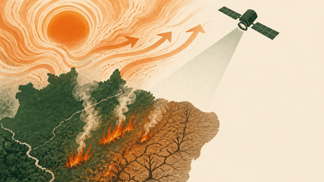
During El Niño, fire activity can appear first in equatorial Asia and later in the central and eastern Amazon, a tropical sequence identified by NASA Earth Observatory. The geography is striking: regions separated by an ocean can face heightened fire risk under the influence of the same Pacific climate pattern. The fires themselves have local beginnings.
El Niño changes where rain falls and how heat builds across parts of the tropics. In an Amazon landscape with dry vegetation, an ignition has a better chance of spreading. Where people clear land, use fire or manage it poorly, the consequences can grow. The sequence maps broad exposure; explaining an individual outbreak requires local weather, land-use and ignition records.
That division of responsibility has practical consequences. A forecast of dry conditions can give communities and authorities time to prepare, but it cannot identify the person, activity or lightning strike that will start the next fire. Nor can a map of active fires, on its own, show how much standing forest has burned. Those questions require different observations.
How the Pacific Reaches the Amazon
El Niño is the warm phase of a recurring fluctuation in the tropical Pacific Ocean and the atmosphere above it. Changes in ocean temperatures alter where moist air rises and where rain-producing clouds form. The effects can extend far beyond the Pacific because tropical atmospheric circulation connects distant regions.
That connection does not impose a single forecast on every part of the Amazon. Rainfall has its own seasonal cycle, and conditions vary across an enormous basin. An El Niño-related shift may leave one area notably drier while another experiences a weaker change. The central and eastern Amazon feature in the fire sequence NASA describes; treating the entire basin as one uniform patch of fuel would erase the geography that makes the pattern useful.
Timing adds another complication. A shortage of rain can change vegetation and soil moisture before a fire appears. Heat can increase evaporation and dry exposed material further. A spell of rain may ease immediate risk in one place even during a broader dry period, while a run of hot, dry days can heighten it elsewhere. El Niño shapes the background conditions; local weather determines what people encounter on the ground this week.
This is why a seasonal climate signal is valuable without being a fire timetable. It can draw attention to places where dryness may develop, giving fire managers a reason to watch conditions closely. It cannot tell them that flames will appear on a particular date.
What Burns Depends on the Landscape
The word Amazon can conjure a continuous canopy of wet forest. Fire risk also runs through cleared land, agricultural areas and forest edges. The distinction affects how a blaze starts and what it can damage. Vegetation on cleared or exposed ground may dry and burn differently from material beneath a shaded canopy; fire that reaches a forest edge can encounter fuel and conditions unlike those in an open field.
Land use therefore belongs near the center of any explanation of Amazon fires. People may set fires for land management, and those fires can escape their intended boundaries when conditions are dry. Fire management, including decisions about where and when burning takes place, influences whether an ignition remains contained. El Niño can increase the chance that vegetation will carry a flame, but the distribution of activity on the land helps determine where flames are introduced.
The stakes also differ by location. A fire on already cleared land and one entering standing forest cannot be treated as identical ecological events simply because both register as heat from above. Smoke can affect people beyond the area that burns. Damage to vegetation depends on what burned, how intensely and whether fire returns. Counting detections is a starting point for investigation, not a complete measure of harm.
Climate change belongs in this picture without becoming a substitute explanation for every outbreak. A warmer atmosphere can increase the demand for moisture from soils and vegetation when other conditions are equal. The severity of any fire season still depends on rainfall, short-term weather, available fuel and human decisions. Those forces can overlap; separating them is how analysts identify risks that can be reduced locally even as the wider climate changes.
Reading the Warning Signs Together
Three observations answer three different questions. Rainfall records show whether an area has received less water than usual for that place and time of year. Measurements or estimates of vegetation dryness show whether plants and other potential fuels may burn more readily. Active fire detections show where sensors identify heat consistent with fire.
Taken together, they tell a more useful story than any single map. A dry rainfall anomaly can appear before fire activity rises, giving managers time to focus attention on vulnerable areas. Dry vegetation alongside new fire detections can sharpen concern about spread. A cluster of detections calls for closer examination of the landscape: Are the fires on cleared land, near forest, or within it? What has the weather been doing locally?
The order of those observations matters. Rainfall and dryness describe susceptibility; fire detections register activity after an ignition. Treating a seasonal drought forecast as a prediction of flames would skip the decisions and events between those stages. Treating detections as a measure of the season's full damage would skip the work of identifying what burned.
The sequence across the tropics offers another reason to monitor rather than wait. If conditions that favor fire activity emerge in one region during an El Niño period, observers can watch for developing dryness elsewhere. That is a way to organize attention across distant places. The relevant question in the Amazon remains local: has rainfall declined, has vegetation dried, and where are ignitions occurring?
A Climate Signal and Local Decisions
Fire management has to operate on both timescales. Seasonal information can guide preparation before conditions deteriorate. Daily weather and observations of fuel dryness can inform decisions when fire risk is immediate. Land-use practices determine how many opportunities a dry landscape has to ignite. Each layer addresses a different point between a Pacific climate shift and a damaging blaze.
That creates difficult choices for people who use fire as part of managing land, as well as for those trying to prevent it from spreading. Restrictions or changes in practice can impose costs; an uncontrolled fire can impose costs on neighbors and on forest that no one intended to burn. The case for acting on an El Niño warning rests on that uncertainty. It offers a chance to reduce exposure before the exact location of a fire is known.
From equatorial Asia to the Amazon, the sequence makes a planetary connection visible. Its value lies in what happens after the signal reaches a particular landscape: whether rain arrives, whether vegetation dries, and whether an ignition becomes a fire that crosses the boundary people expected it to obey.
More Like This

Stroke Risk Peaks in the First Three Months After a Cancer Diagnosis
New research in Cancer finds stroke risk rises 2.5-fold in the first three months after a cancer diagnosis, especially with pancreatic and lung cancers.
A Victorian Train Delay Exposes Space Weather Risk
A disputed Victorian train delay links geomagnetic activity to telegraph faults, showing how space weather affected systems before satellites and power grids.
Montana's JM Reef and America's Platinum Supply Problem
The JM Reef in Montana is America's only platinum and palladium source. What that means for clean energy, emissions tech, and supply chain security.

Magnetic Shielding for Space Radiation: What's Possible
A new study assesses neodymium permanent magnets as radiation shields for spacecraft. Here's what the physics allows, what it doesn't, and why this problem won't go away.
Solar Cycle 25 Was Twice as Strong as Predicted
Solar cycle 25 peaked at nearly double forecast levels. Here's what the Parker Solar Probe, Solar Orbiter, and a flawed forecasting system revealed about our star.
Anil Menon Reaches the ISS on His First Spaceflight
NASA astronaut Anil Menon launched to the ISS on July 14 aboard Soyuz MS-29. His eight-month mission raises questions about what space cooperation looks like next.