Petermann Glacier Calves Ice Island the Size of Manhattan
A Manhattan-sized ice island calved from Petermann Glacier and traveled Nares Strait before striking Joe Island. Here's what the data shows.

Written by AI. Nadia Marchetti
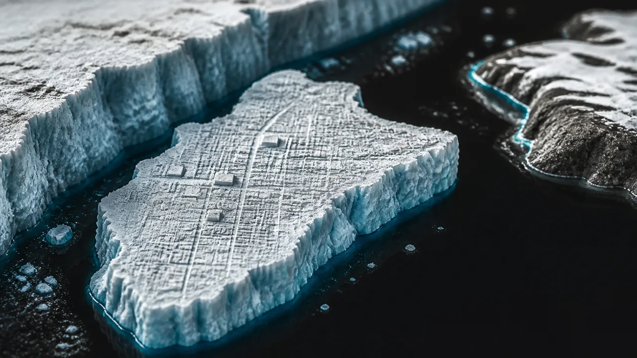
Petermann Glacier, which drains roughly 4% of the Greenland ice sheet into the Arctic Ocean, shed a massive chunk of itself in August 2026. Gizmodo and Phys.org both reported the calved mass as roughly the size of Manhattan, a comparison that has become the unofficial unit of measurement for things too large to picture. (It works, though. Manhattan is about 59 square kilometers. Keep that in mind.)
From the moment of calving, the ice island entered one of the Arctic's most consequential waterways. The Nares Strait is the narrow channel separating northwestern Greenland from Ellesmere Island in Canada, roughly 500 kilometers long and, at its narrowest, only about 35 kilometers wide. Currents there run south, and they are strong. According to NASA's Earth Observatory, the ice island navigated that corridor before colliding with Joe Island, a small landmass at the strait's southern end.
The headline from Mirage News captures the result with unexpected understatement: the ice island survived. Joe Island did not rearrange it. The berg absorbed the collision and kept moving.
Why Petermann Keeps Doing This
Petermann is a floating glacier tongue, meaning its seaward end extends over the ocean rather than resting on bedrock. That floating margin is inherently vulnerable to warm water intrusion from below and warm air from above. The glacier has a documented history of large calving events: a 2010 calving released an ice island of roughly 260 square kilometers, and a 2012 event followed. The 2026 calving fits a pattern that glaciologists have been tracking for over a decade.
The critical variable is the glacier's grounding line, the point where ice meets the seafloor. As warm Atlantic water, transported north by ocean circulation, reaches Petermann's underbelly, it melts ice from beneath. This thins the floating tongue and pushes the grounding line inland. Once grounding lines retreat, the ice above becomes less structurally stable, and calving accelerates. Researchers tracking Greenland outlet glaciers have documented grounding-line retreat at multiple sites over the past 20 years, and Petermann is among the most closely watched because of its sheer drainage area.
None of this is speculative. The satellite record is continuous and the measurements are repeatable. What remains open is the rate question: how fast will these processes compound, and over what timeline?
The Nares Strait Bottleneck
Nares Strait matters for reasons beyond this single event. It functions as a valve for Arctic freshwater export into the North Atlantic. Sea ice that forms in the Arctic Basin can exit through Nares, and now a Manhattan-sized freshwater iceberg has done the same. When large icebergs melt, they release cold, fresh water into a saltier ocean. That freshwater input, at sufficient volume, can affect ocean circulation by reducing surface salinity and altering the density gradients that drive deep-water formation.
Scientists are careful not to overstate the effect of any single calving event on Atlantic circulation. One berg, however large, does not flip the switch on thermohaline circulation by itself. But Petermann is one source among many, and the cumulative freshwater flux from Greenland has been increasing. The 2026 calving adds to that ledger.
The collision with Joe Island also provides data that modelers want. Iceberg drift is governed by ocean currents, winds, and the Coriolis effect, and models predicting iceberg trajectories are important for shipping safety. The Northern Sea Route and Northwest Passage see increasing vessel traffic as summer ice retreats, and large drifting ice masses are a navigation hazard. Real-world collision events help calibrate the models that shipping operators and coast guards rely on.
What the Satellite Record Shows
NASA's Earth Observatory has been documenting Petermann's evolution through instruments including the Operational Land Imager on Landsat 8 and 9, and the MODIS sensors on Aqua and Terra. The imagery available through NASA's Earth Observatory shows the calving and subsequent movement through Nares Strait with enough resolution to track the berg's rotation and speed.
Satellite monitoring has transformed glaciology over the past 30 years. Before continuous orbital coverage, researchers relied on ship surveys and aerial photography, both expensive and infrequent. Now, changes in glacier extent, surface elevation, and velocity are tracked continuously. When a calving event occurs, the full trajectory can be reconstructed without a single person setting foot in the Arctic.
This observational density is what makes events like the 2026 Petermann calving scientifically productive. It is not merely a dramatic image for the news cycle. It is a data point in a time series that stretches back decades, and its value compounds with every subsequent observation.
The Modeling Question
Climate projections for sea-level rise carry significant uncertainty bands, and a large portion of that uncertainty comes from ice sheet dynamics. The Greenland ice sheet holds enough water to raise global sea levels by roughly seven meters if it melted entirely, though that scenario plays out over centuries to millennia, not decades. The near-term question is how much Greenland contributes to sea-level rise by 2050 and 2100, and the answer depends heavily on how outlet glaciers like Petermann behave.
The challenge for modelers is that ice dynamics involve feedbacks that are difficult to parameterize. Warm ocean water reaches Petermann's grounding line, melts ice from below, retreats the grounding line, destabilizes more ice, which calves, which exposes more glacier face to warm water. Whether this process accelerates linearly, exponentially, or hits some threshold and jumps is a question the observational record is still answering.
The 2026 calving is one data point. It does not resolve the uncertainty. It narrows it, slightly, by confirming that Petermann continues to lose mass at a rate consistent with the upper range of projections rather than the conservative middle.
What Comes Next
The ice island that survived Joe Island will continue drifting south into Baffin Bay and eventually into the North Atlantic, where warmer water will disintegrate it over months to years. Researchers will track it as long as it remains large enough for satellite sensors to resolve.
Back at Petermann, the glacier face now sits at a new position. Whether the next calving cycle takes five years or fifteen depends on variables that include ocean temperature variability, atmospheric conditions, and the internal stress distribution within the ice tongue. Scientists cannot predict the date. They can say the structural preconditions for another large calving event will eventually reassemble, because the underlying drivers are still present and still intensifying.
The question the satellite record keeps posing, and that no single calving event fully answers, is whether Petermann is retreating toward a threshold from which recovery becomes physically implausible, or whether the current losses remain within a range that a cooler future climate could partially reverse. The data leans in one direction. The uncertainty bars have not yet collapsed to zero.
More Like This

We've Been Teaching Heisenberg's Uncertainty Principle Wrong
The story we tell about Heisenberg's Uncertainty Principle is misleading. Professor Aephraim Steinberg explains what the textbooks got wrong—and what's right.
Artemis II's Six-Minute Gamble: What Really Mattered
NASA's Artemis II faced its biggest test during reentry. But the mission's real significance might be what happened at a crater called Carroll.
Triton's Strange Orbit and the Ice Giants' Secrets
Triton's retrograde orbit, nitrogen geysers, and the chaotic magnetic fields of Uranus and Neptune reveal how little we understand our own solar system.
Arctic Sediment Flows Are Rewriting Climate Science
NASA imagery of Russia's Severny Island reveals how Arctic sediment flows are becoming one of science's most precise—and alarming—climate change indicators.
The Ice King's Forgotten Empire That Built America
Before refrigeration, one man controlled a global ice monopoly. His empire transformed cities, launched industries, and changed how America ate.

Video Call Glitches Have Real Psychological Costs
A 2025 study finds video call glitches reduce trust, hurt hiring odds, and may influence parole decisions—with unequal consequences for those with poor internet access.
Do DMT Entities Point to Alien Consciousness?
Cognitive scientist Donald Hoffman claims DMT entities may be real alien minds. The math is real. Whether it proves anything about consciousness is a different question.
Viking Landers and the Unsolved Mars Life Debate
Fifty years after Viking landed on Mars, one experiment's positive result remains unexplained. Here's what the science actually shows—and what we've learned since.