Indonesia's Peatland Fires Are Burning Underground
Indonesia's peatland fires are smoldering underground, spreading toxic haze across Southeast Asia. Here's what the satellite data and ground reports reveal.

Written by AI. Nadia Marchetti
Satellites operated by NASA's Aqua mission have been tracking something that looks, from orbit, like a country on fire. Broad swaths of Kalimantan and Sumatra are lit with thermal anomalies, plumes spreading west toward Malaysia and north toward the Philippines. But the most consequential burning in Indonesia right now is the kind you cannot see at all from 700 kilometers up.
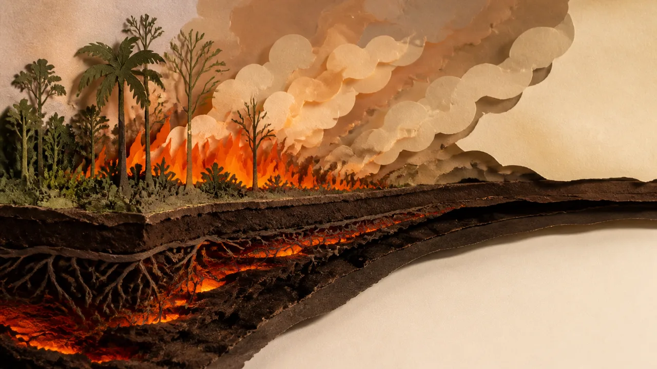
Peat burns underground.
Picture a layer of ancient, compressed organic material, sometimes ten meters deep, saturated for millennia and now, after a prolonged drought, dry enough to sustain combustion. No flame. No visible smoke column at the surface. Just slow, creeping heat moving through the earth, consuming centuries of stored carbon from below. According to NASA's Earth observation reporting, Indonesia's peat fires occur both at the surface and underground, and it is the underground component that makes them so hard to extinguish. Water poured onto the surface drains around the combustion zone. Fire crews have documented peat fires that tunneled under roads and re-emerged on the other side. You can stamp out a campfire. You cannot stamp out a burning continent.
The trigger this season is El Niño. Mongabay reported in July that fears were already building around the possibility of a strong El Niño event driving severe drought across Indonesia's tropical peatlands, the same climatic pattern that produced the catastrophic 2015 fire season. That year's fires are a reference point worth understanding: the peat burned so extensively and released so much carbon that the 2015 event temporarily disrupted global atmospheric CO2 measurements. The 2015 figure has been cited in research contexts as among the largest single-year carbon pulse events in recorded history, though I am not going to attach a specific national comparison to that claim without a citable study to anchor it. What the satellite record does confirm, and what NASA's Aqua mission data shows, is that Indonesia's peatlands represent one of the densest carbon stores on Earth, and when they burn, they release carbon that accumulated over thousands of years in a matter of weeks.
There is a strangeness here that deserves more than a technical explanation. Peat is, in a sense, a very slow version of coal. It is what coal was before geological time finished compressing it. When Indonesia's peatlands burn, the planet is essentially running a geological process in fast-forward, converting a carbon archive into atmosphere at a pace evolution never anticipated. The smoke you see from satellite imagery is the receipt. The carbon bill is invisible and arrives over decades.
On the ground, the receipt is very visible. NPR reported on August 25 that Indonesians were braving choking smoke to pray for rain as the country battled wildfires, a detail that carries more information than it might first appear. Communal rain prayers are not a casual response. They happen when people have run out of other options, when the smoke has been sitting over a village for long enough that the air itself feels like a threat. Community health workers in peat-affected districts have described going door to door distributing masks to elderly residents and children, and advising families with respiratory conditions to stay indoors for days at a stretch. Schools in parts of Kalimantan have closed during previous fire seasons when air quality indices exceeded safe thresholds by factors of ten or more. The 2026 season is tracking toward similar conditions.
The haze has crossed borders. BBC News reported that toxic wildfire haze was spreading across Southeast Asia as what it described as a 'super' El Niño intensifies, and a separate BBC live report tracked the haze spreading specifically to Malaysia and the Philippines. This is not a new pattern. The 1997 and 2015 fire seasons both produced transboundary haze events severe enough to trigger diplomatic friction between Indonesia and its neighbors. What changes with each cycle is the political baseline: more people, more urban populations near the affected corridors, and a global climate agreement framework that is supposed to be tracking exactly this kind of carbon release.
The land management question does not have a clean answer.
Most of Indonesia's peatland fires are not spontaneous. They are set, either deliberately or as a byproduct of land clearing for agriculture, primarily palm oil and pulpwood plantations. The people who light fires to clear land for subsistence farming are a different population from the plantation companies that have historically used fire as the cheapest clearing method at industrial scale. Smallholders in Kalimantan often have no practical alternative to fire for clearing; they lack the equipment, capital, and market access that would make mechanical clearing viable. The plantation sector has the resources and has repeatedly been the subject of legal action and satellite-monitored concession violations. Treating these as a single category of actor obscures who bears the cost of the policy changes needed and who captures the benefit of the status quo.
The Indonesian government has imposed burning bans, pursued criminal prosecutions of plantation companies in high-profile cases, and established the Peatland Restoration Agency (BRG) after 2015 with a mandate to rewet degraded peat across 2 million hectares by 2020. The rewetting target was not met. Hydrological restoration of peat requires maintaining water tables above the level at which peat becomes combustible, and doing that across fragmented concession land with competing ownership interests is an administrative and engineering problem that annual fire suppression budgets cannot substitute for.
What NASA's satellite data does that fire suppression crews on the ground cannot is show the full spatial extent of active burning at once, tracking hotspot counts and smoke aerosol concentrations across the archipelago. The Aqua mission's MODIS instrument has been providing this kind of coverage since 2002, and the record it has built is one of the clearest documents of how peat fire frequency correlates with ENSO cycles. A strong El Niño in 2026 means a drier-than-normal dry season across Indonesia, and drier-than-normal is precisely the condition under which peat that was barely holding its moisture crosses the threshold into combustibility.
The underground fire problem has a specific endpoint that rarely gets discussed: once peat burns down to the mineral soil layer beneath it, that land cannot support peat regrowth on any timescale relevant to climate policy. It becomes degraded, subsidence-prone ground. Parts of coastal Kalimantan are already sinking partly because the peat beneath them has burned away or decomposed, and the areas most at risk from sea-level rise are, not coincidentally, also the areas where peat loss has been most severe. By 2050, some low-lying peat districts in Kalimantan face a compounding scenario: land that has already lost its carbon store, already lost elevation, now facing tidal inundation. The fires visible on satellite imagery today are producing that outcome incrementally, season by season.
The rain prayers in the villages of Kalimantan are asking for something specific: enough water to raise the water table back above the combustion zone, to close the gap between what the peat needs to survive and what the drought is giving it. In 2015, the rains eventually came with the wet season. The fires went out. The carbon stayed in the atmosphere. Across Indonesia's peatlands, an estimated 14.6 million hectares of degraded peat remain at risk of burning in the next severe drought, according to restoration agency estimates cited in environmental monitoring reports. The next El Niño will find them in the same condition as this one, unless the rewetting work scales up by an order of magnitude. That is the concrete shape of the problem: 14.6 million hectares, and a restoration program that has covered a fraction of them.
More Like This

We've Been Teaching Heisenberg's Uncertainty Principle Wrong
The story we tell about Heisenberg's Uncertainty Principle is misleading. Professor Aephraim Steinberg explains what the textbooks got wrong—and what's right.

Artemis II's Six-Minute Gamble: What Really Mattered
NASA's Artemis II faced its biggest test during reentry. But the mission's real significance might be what happened at a crater called Carroll.
El Niño 2026 Could Be Among the Strongest on Record
NOAA gives a greater than 90% chance of a very strong El Niño by late 2026. Here is what the forecasts actually say, and what they do not.
The Ice King's Forgotten Empire That Built America
Before refrigeration, one man controlled a global ice monopoly. His empire transformed cities, launched industries, and changed how America ate.

Video Call Glitches Have Real Psychological Costs
A 2025 study finds video call glitches reduce trust, hurt hiring odds, and may influence parole decisions—with unequal consequences for those with poor internet access.
UK Wildfires Leave Habitats Facing Centuries of Recovery
From Welsh peatlands to Suffolk heathland, recent UK wildfires have set back ecosystems by decades or centuries. Here's what recovery actually looks like.

A Physicist Calls UFO Disclosure a Distraction
Physicist Brian Keating tore through the latest government UFO release and found nothing. His argument: the timing alone makes it suspect.

Do DMT Entities Point to Alien Consciousness?
Cognitive scientist Donald Hoffman claims DMT entities may be real alien minds. The math is real. Whether it proves anything about consciousness is a different question.