How the San Juan River Carved Utah's Gooseneck Canyons
Utah's San Juan River cuts deep loops through the desert. Explore how inherited bends, uplift and erosion formed the goosenecks, and what the landscape reveals.

Written by AI. Nadia Marchetti
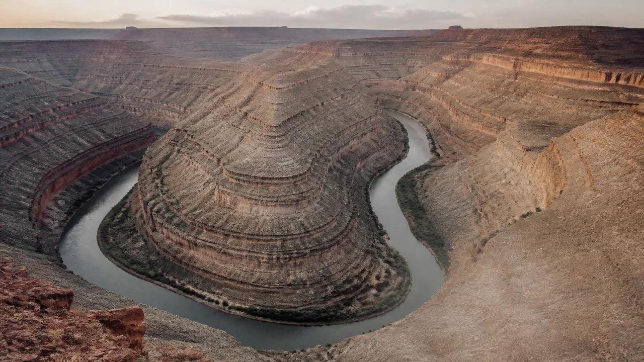
The San Juan River makes a series of tight turns through southeastern Utah, and the canyon walls follow every bend. From above, the river looks like a winding line pressed deep into the plateau. That pairing of curves and steep rock walls is the clue: the water did not have to find its way around each wall. The walls formed as the river cut down along a winding course.
These bends are called entrenched meanders. NASA's view of the goosenecks shows why the term fits: the San Juan traces broad loops through terrain that rises well above the channel. At Goosenecks State Park, a visitor can look down into those loops from the canyon rim. The Utah Geological Survey calls such sinuous canyons and valleys goosenecks, after the shape of a goose's neck.
The shape invites a deceptively simple question. Rivers curve all the time. How did this one keep its curves while cutting a deep canyon?
A Winding Course, Then a Deeper Cut
A river flowing across relatively gentle terrain can migrate sideways. Water moves faster along the outside of a bend, where it can erode the bank; slower water on the inside can leave sediment behind. Over time, that combination helps a meander change shape and position. Anyone who has looked at a winding river on a broad floodplain has seen the result: loops with room to roam.
The San Juan's loops now occupy a much narrower setting. As the surrounding landscape rose during a period of geological uplift, the river continued to cut into it, carving the bends visible from Goosenecks State Park. The river's route became entrenched as downward erosion took on a larger role. Its winding course was carried into the rock below.
Picture drawing a curve across a stack of paper, then cutting through the stack along that line. Each lower sheet inherits the curve even though the cut gets deeper. Rock is considerably less cooperative than paper, and the river did its cutting over geological time. Still, the analogy explains the plan view: a bend that developed when the channel had more freedom to move can remain recognizable after incision gives it high walls.
Uplift and erosion work together in this account. Raising the land relative to a river's downstream level can increase the potential for a channel to cut downward. Flowing water then carries loosened rock and sediment away. The visible canyon records the river's response to a changing landscape, while the river's loops preserve an earlier feature of its route.
What the View from Above Can Tell Us
A satellite image makes the goosenecks easier to read as one connected landform. On the ground, a canyon wall can fill your view; from above, consecutive loops show that the channel repeatedly doubles back through the plateau. The curves belong to one river, and the canyon follows them.
That geometry supports the entrenched-meander explanation, but shape alone cannot date when the San Juan began cutting down. A sharp bend on an image does not reveal an erosion rate or a complete sequence of uplift events. Those questions require measurements and geological work beyond tracing the channel on a map.
The difference between an overhead view and a canyon-rim view is useful rather than frustrating. The overhead view shows the relationship among bends. At the rim, exposed rock layers show the material the river has cut through. Together, those perspectives let a visitor connect the route of the water to the depth of its incision. Neither asks the landscape to supply a stopwatch it does not carry.
The Utah Geological Survey's description of the state park places the overlook at the edge of this terrain. That matters for more than photography. From a fixed point above the river, the channel's repeated turns and the height of the surrounding land can appear in a single view. What looks, in isolation, like one dramatic horseshoe is part of a longer winding course.
Why the River Kept Its Bends
The most intriguing feature of an entrenched meander is its apparent stubbornness. A straight route across a loop would be shorter. Water, however, flows through a channel shaped by earlier conditions; it does not survey the plateau and select the shortest line on a map. Once a winding channel cuts deeply into bedrock, changing course means eroding a new route through that rock. Continuing down the existing route can remain the path of least resistance.
That does not make the bends permanent. Rivers continue to erode, and canyon walls can weather and shed material. It means the goosenecks should be understood as a stage in a continuing process, with an inherited course still legible in the canyon's outline.
The arid surroundings can make the effect seem stranger than it is. A narrow ribbon of water sits far below a broad expanse of exposed rock. Yet the landform reflects accumulated erosion, not the work of a single visible flow. A present-day glance at the river cannot stand in for the long history recorded in the walls around it.
The goosenecks also show why a landscape can preserve two kinds of history at once. The river's sideways curves speak to the development of its course. The canyon's depth speaks to later downward cutting as the terrain rose. Reading only the loops misses the walls; reading only the walls misses the inherited loops.
Reading a Landscape Without Rushing It
Geologists test stories about landforms by asking what each proposed process would leave behind. For the San Juan, the linked, sinuous canyon and the river occupying its floor fit a channel that maintained its bends while eroding downward. Exposed layers offer a way to examine what the water cut through. The broader terrain offers context for how a river could move from a more open setting into a confined one.
The details of timing demand more than a scenic image. Dating rock layers, examining deposits left by former river levels and comparing elevations across a region are among the ways researchers can investigate a canyon's history. The age of a rock layer, for example, tells us about the rock's formation; it does not automatically give the age of the canyon cut through it. Confusing those two ages would make a tidy story, but a poor geological clock.
Goosenecks State Park offers a rare advantage for readers of landscapes: the broad pattern is visible without needing to reconstruct every turn from scattered outcrops. Look at the river, then at the walls wrapped around it. The San Juan's route and its downward cut are both there, drawn on the same piece of Utah.
More Like This

Neil Turok's Case for Quantum Gravity Without Strings
Neil Turok argues quadratic gravity—a 1970s idea—may solve quantum gravity without strings or extra dimensions. Here's what that claim actually rests on.

Statins May Cut Dementia Risk in Type 2 Diabetes
A major study finds early statin use after a type 2 diabetes diagnosis is linked to up to 15% lower dementia risk. Here's what the evidence actually shows.
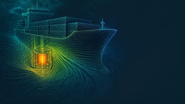
America Wants Nuclear Cargo Ships by 2028: The Real Obstacles
A MARAD-Core Power agreement targets nuclear merchant ships laid down from 2028. The reactor is the easy part; lawyers, insurers and ports are not.
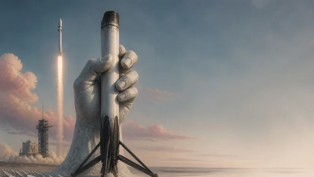
SpaceX Hits 600 Falcon 9 Booster Reuses
SpaceX reached 600 flight-proven Falcon 9 booster launches on July 13-14, 2026. Here's what that number actually means for spaceflight economics.
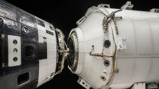
Artemis III Orion Modules Joined at Kennedy Space Center
NASA technicians joined the Artemis III Orion crew and service modules on July 30, 2026 — real flight hardware, in the building where Apollo spacecraft were checked out.

Michael Shermer on Truth, Bias, and the Post-Truth Era
Neil deGrasse Tyson and Michael Shermer unpack objective truth, motivated reasoning, and why your brain argues like a lawyer, not a scientist.