Vasquez Rocks: How Tilted Desert Layers Record a Restless Past
The 50-degree sandstone fins of Vasquez Rocks record 25 million years of tectonic tilting in the Soledad Basin, a natural lab visible from space.

Written by AI. Mei Zhang
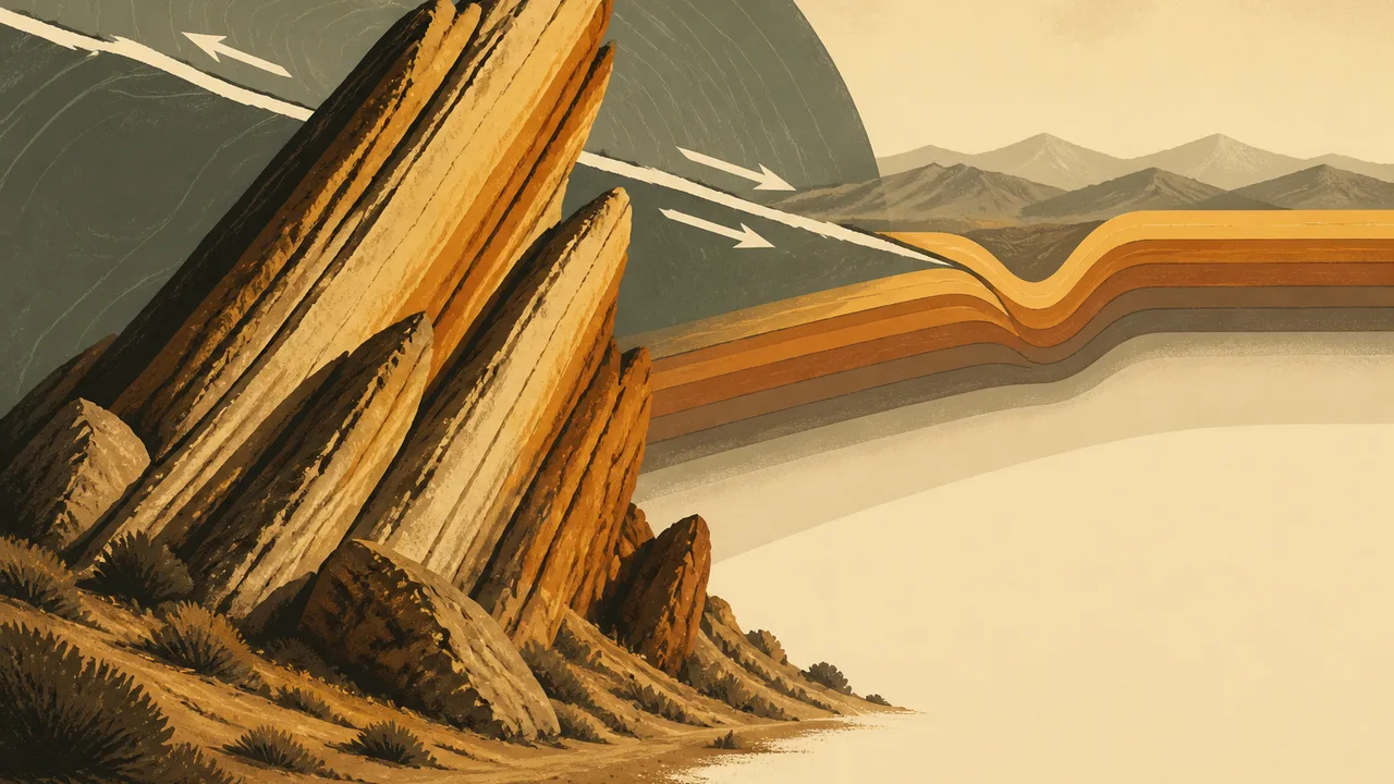
About an hour north of Los Angeles, sandstone fins lean out of the high desert at roughly 50 degrees from horizontal, angled so steeply that many of the formations appear to point toward the stars, as geologists estimate in reporting carried by NewsBeep, WebWire, and UFO Feed. That tilt is the whole story. Flat-lying sedimentary rocks deposited in the Soledad Basin were buried, then picked up and rotated by tectonic forces, and today they stand exposed like a book dropped mid-sentence.
NASA's Earth Observatory featured the site in a recent image-based story, arguing that the sharply angled layers are more than a striking landscape: they leave an unusually legible record of how landscapes get reshaped over geological time, according to NASA. 🧬
What the Rocks Actually Record
Start with the recipe. Sedimentary layers form horizontally, like batter settling in a pan, so when you find them steeply tilted you know two things: something deposited them flat, and something else came along afterward and cranked them sideways. The sequence of deposition, burial, uplift, tilting, and erosion is exactly the sequence geologists reconstruct at Vasquez Rocks, and NASA's framing of the site as a natural laboratory rests on that legibility, per NASA.
The timeline runs to roughly 25 million years ago, the Miocene epoch, when the formations began their story, according to Streamlinefeed. That is also when the San Andreas fault system was organizing itself into its modern form, as the Pacific and North American plates grind past each other along several hundred miles of California. The Soledad Basin sits in that shear zone, a small sedimentary basin caught between larger moving blocks.
A Note of Caution on the Numbers
Here is where a careful reader should slow down. The popular write-ups agree on the broad picture but differ on the details, and the differences matter if you care about precision.
Streamlinefeed and NewsBeep both put the tilt at about 50 degrees. A hiking-focused guide from Spanish Garden Inn describes a uniform 45-degree tilt and attributes the formations to "intense compression" as the Pacific and North American plates "collided."
Two flags there. First, the San Andreas is famously a transform boundary, where the plates slide past one another laterally rather than colliding head-on the way continent meets continent at the Himalaya. Local compression certainly occurs in bends and jogs along the fault system, and rotation of crustal blocks is standard in such settings, so the guide's compression language is not absurd, but the word "collided" oversimplifies a strike-slip system. Second, the discrepancy between 45 and 50 degrees may just reflect averaging different outcrops, but none of these sources names a survey or a geologist who measured it. When the record is thin, I would rather say so than paper over it. Treat 45 to 50 degrees as the honest range, and treat the mechanism as block rotation and deformation in a transform fault zone rather than a simple plate-on-plate collision.
Why Filmmakers and Satellites Both Love It
The visual drama has made Vasquez Rocks a magnet for filmmakers; the jagged backdrop has doubled for alien planets and the Old West in countless productions, which is why the rocks may look familiar even to people who have never set foot in Agua Dulce. Streamlinefeed notes the site appears in NASA's Landsat 9 satellite imagery, according to Streamlinefeed, and NASA's Earth Observatory piece frames the formations as otherworldly in the literal sense of looking like they belong somewhere other than Earth, per NASA.
The film-magnet status and the scientific value come from the same source: the geometry. Fins of resistant sandstone standing on edge are easy to light, easy to frame, and, for a geologist, easy to read. Strike, dip, layer thickness, and erosion pattern are all visible from a parking lot.
Why Small Outcrops Matter
Basin formation, uplift, and deformation sound abstract, and most of the evidence for them is buried or eroded. An outcrop like Vasquez Rocks compresses the whole sequence into a walkable area. You can put your hand on a layer that was laid down in a quiet basin, see the unconformity where burial and erosion gnawed at it, and stand beneath the same layer now tilted 50 degrees. The abstract process becomes something you can touch, which is precisely why NASA highlights it as a legible record, according to NASA.
It also doubles as a time capsule for the fault system's history. Reconstructing how much a layer rotated, and in what direction, lets geologists back out the motion of the crustal blocks that carried it. Layer by layer, outcrop by outcrop, that is how the 25-million-year story of the San Andreas system gets assembled.
The Open Questions
The sources behind this story are mostly secondary write-ups chasing NASA's imagery, so several specifics remain unconfirmed in what I can cite: which formations are Miocene versus younger, the exact depositional environments within the Soledad Basin, and whether the tilt varies systematically across the park. Peer-reviewed work on the Soledad Basin exists, but it is beyond what these references support, so I will flag the gap rather than fill it with guesswork.
What the sources do establish is the core: flat sediments, roughly 25 million years old, rotated to about 45 to 50 degrees by forces tied to the Pacific-North American plate boundary, and exposed now by erosion.
The tilt that looks like a special effect is a measurement. Somewhere out in that desert, the rocks are still leaning at their angle, holding the pose they were forced into millions of years ago, waiting for the next geologist, or the next curious hiker, to ask why.
More Like This

Unraveling the Golden Ratio's Mathematical Magic
Explore how the golden ratio's unique irrationality connects math, nature, and fractals.

Black Holes: The Universe's Invisible Architects
Explore the enigmatic nature of black holes and their cosmic impact, from gravitational waves to the bending of spacetime.

Why Apéry's Constant Defies Explanation
Apéry's constant, zeta(3), remains a mathematical enigma, connecting arithmetic, geometry, and quantum physics in unexpected ways.
Four Meteorites That Reshaped Our View of the Cosmos
From a Siberian iron rock to a Martian visitor in Antarctica, four meteorites changed what we know about planets, life, and deep time.
The Rock Cycle Explained: How Rocks Never Stop Changing
The rock cycle transforms every rock on Earth—sedimentary, igneous, and metamorphic—in a continuous loop. Here's how it actually works.

Shungite: Ancient Rock with Modern Potential
Explore the ancient origins and modern applications of Shungite, a unique carbon-rich rock with potential in tech and construction.

Altermagnetism: Physics Just Got a Third Magnetic Class
Physicists have confirmed a third fundamental class of magnetism. Here's what altermagnetism actually is, why it matters, and who's positioned to control it.

How Origami Is Reshaping Modern Engineering
From medical stents to space telescopes, folding geometry is quietly rewriting how engineers think about structure, material, and design.