Searching for London's First Roman Road Under Lambeth
Time Team investigates whether London's first Roman road ran through Lambeth Palace gardens—and why the Romans crossed the Thames there before building Londinium.
Written by AI. Helen Papadopoulos
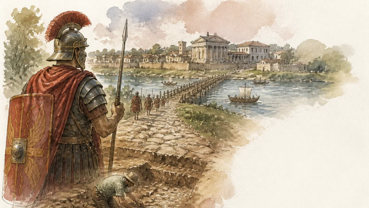
Photo: AI. Júlia Almeida
There is a kink in London's ancient spine, and it has been nagging at archaeologists for decades. The Roman road from Canterbury — the route the legions would have marched upon their invasion of Britain in 43 AD — runs straight as a surveyor's ambition right up to the southern reaches of the city. Then, inexplicably, it bends. A dog leg northward, following the meander of the Thames to London Bridge. The Romans did not build dog legs without reasons. Dog legs are admissions of defeat — a later adjustment, a pragmatic detour around some obstacle that no longer exists. Extend the road's original trajectory in a straight line, and you hit the Thames not at London Bridge but some distance upstream, at Lambeth.
This is the premise that drives a Time Team investigation into one of London's most compelling buried questions: did the first Roman road into the city cross the river at Lambeth, and if so, does that mean the true birthplace of Londinium lies not in the City at all?
A 60-Year-Old Hunch
The team's entry point is a figure named Bernard Davis, an amateur archaeologist who dug trenches in the gardens of Lambeth Palace in 1935 and believed he had found the remains of that original Roman road. His paper sat in the archive for six decades, unchallenged but also unverified. The grounds of Lambeth Palace — London home of the Archbishops of Canterbury since 1170 — had remained largely undisturbed since the medieval period, making them a rare patch of unbuilt south London where a spade might still find something ancient. Roman pottery had already turned up in the grounds in recent years. Davis's claim deserved a second look.
The initial logic is hard to argue with. Project the Old Kent Road — the modern ghost of Watling Street — northward, and it aims squarely at Lambeth. Cross the river, and on the other bank, Watling Street (the A5, heading northwest toward the Midlands) also converges on the same point. As the team's Mick notes in the episode, both roads sharing the same name implies they were originally one continuous route: "The implication here is that there was some sort of ford or bridge or something like that." One road. One crossing. One first moment of London.
What the Thames Used to Be
Before the team can dig meaningfully, they have to understand that the Thames they are excavating around bears essentially no resemblance to the river the Romans waded. Museum of London archaeologist Gus Mil, surveyed from a boat, makes this plain: "What we see here, this river, is nothing like the Roman River. It's dirtier. It's much deeper. It's narrower. And it has a much greater tidal range than in the Roman period." The Roman Thames near present-day London Bridge was nearly a kilometre wide at high tide. The Roman riverbank at the City lay roughly 150 metres north of where the present river runs. A Roman boat was found in 1958 in the grounds of Guy's Hospital — far inland by today's reckoning — demonstrating how dramatically the geography has shifted. Bones of a city can move.
This matters enormously for the Lambeth investigation. A river that was shallower, wider, and less tidally aggressive in the Roman period would have made fording far more plausible at multiple points. What today looks like an implausible crossing — over a navigable urban waterway — may have been, in 43 AD, a manageable wade at low tide, particularly at a spot where a sandbar happened to reach across.
The Archaeology Does Not Cooperate
Here is where the story becomes instructive rather than triumphant, and why it deserves more than a headline. The team digs a twenty-metre trench in the Lambeth Palace gardens, runs geophysical surveys across the palace grounds and neighbouring park, sinks core samples to find ancient gravel — the dry land the Romans would have needed to lay a road — and comes up largely empty. What they eventually find in the trench is not a Roman road. It is an eighteenth-century formal garden. Gravel terraces. A canalised water channel. Stuart, examining the stratigraphy, delivers the verdict with the resigned clarity of someone who has watched archaeology devour assumptions before: "I think you're digging garden features... I don't think it's a Roman road. I think the layout's too good."
Which raises the uncomfortable question of what Davis actually saw in 1935. Harvey Sheldon, the team's authority on Roman London, explains the likely answer: "It happens today that people when looking for Roman roads, they see layers of natural sand and natural gravel. And when they get the gravel, they think that they've actually found the line of the Roman road itself." Davis saw gravel and saw what he wanted to see. It is one of the most common and forgivable errors in field archaeology — gravel is gravel until it is demonstrably engineered, and distinguishing the two requires more than enthusiasm.
Where, Then?
The investigation pivots. Davis was looking in the wrong part of the grounds; the team comes to believe the road passed north of the palace gardens entirely, somewhere in the vicinity of what is now St. Thomas's Hospital — a site comprehensively buried under modern development and therefore, frustratingly, untouchable. Robin's archival work in the palace library finds a reference on a 1562 map to "Stangate stairs" — stairs down to the river leading to a crossing directly to Westminster, with an ancient road leading to them. Stangate, almost certainly Saxon in origin and likely meaning "stone gate," appears in thirteenth-century episcopal registers as an ancient way. Overlay an eighteenth-century map of London onto a modern Ordnance Survey grid, and Stangate stairs fall directly beneath the Florence Nightingale statue in the grounds of St. Thomas's Hospital.
Meanwhile, Mick and Corenza commandeer a London Fire Brigade boat and drag a tape measure over the side to take depth soundings opposite Thorny Island — the ancient island now occupied by the Houses of Parliament. The river bottom at that point, which in Roman times would have been two metres shallower, comes up as barely seven and a half feet. A local boatman confirms a sandbar that stretches across this stretch of the Thames. "We might almost be looking at a ridge across here if it existed in Roman time," notes one of the team. "Almost walk across, sort of thing."
Two Criteria, One River
The investigation closes on a distinction that illuminates not just Roman London but how Roman colonisation actually worked. Lambeth and the City served different purposes, and the difference explains why Londinium grew where it did rather than at the point of first crossing.
Harvey Sheldon frames it cleanly: "While Westminster is a good crossing place, if you just want to get from A to B, if you actually want a good berthing place where you want to bring deep water vessels as far into the country as you can, then London is a better place. You can put a crossing there, but you can also have a port." Lambeth offered a shallow ford, ideal for an army in a hurry. The City offered deeper water, higher ground, and the infrastructure of commerce. First you conquer; then you settle; then you build. The road and crossing at Lambeth served phase one. The bridge and port at the City served everything that came after.
The 3D topographical model the team constructs from bore hole data, British Geological Survey records, and their own measurements confirms a gravel ridge running north of the palace gardens along the Lambeth bank — precisely the kind of dry land a Roman engineer would have used for a road foundation in otherwise marshy terrain. Combine that ridge with the sandbar crossing, align it with the Stangate evidence, and the picture that emerges is coherent, if not yet proven: Roman legions crossing a shallow Thames at low tide to Thorny Island, then moving inland through what are now St. James's Park and Green Park, striking northwestward along the line that would become the Edgware Road.
The Roman pottery and heavy roof tiles recovered from the Lambeth trench — tiles suggesting an administrative structure, not just a casual campsite — imply that people stayed at this crossing long enough to build. Not a city, but something more than a waystation. The dog leg at London Bridge is not, therefore, evidence that London began at London Bridge. It is evidence that London moved.
What Lies Beneath St. Thomas's
The frustrating terminus of all this is the same one that confronts urban archaeology everywhere: the most important ground is usually the most buried. The site where the team now believes the road actually ran — somewhere in the footprint of St. Thomas's Hospital — cannot be excavated without demolishing a working hospital. The answer is there. It is simply inaccessible.
What the investigation does accomplish is something less dramatic but more durable: it demolishes Davis's specific claim while strengthening the broader argument he was groping toward. The road did not pass through the archbishop's garden. But it did pass through Lambeth. The crossing was not at London Bridge. It was, in all probability, near what is now Westminster Bridge, at a point where the river could be forded at low tide across a sandbar to an island that became the foundation of British parliamentary democracy.
The Romans, characteristically, chose their ground with precision. Londoners have been building over the evidence ever since.
By Helen Papadopoulos, Ancient World Correspondent
We Watch Tech YouTube So You Don't Have To
Get the week's best tech insights, summarized and delivered to your inbox. No fluff, no spam.
More Like This
WW1 Trench Life: What the Western Front Was Really Like
From Pals' Battalions to the Vickers gun, a new documentary unpacks the grim machinery of survival on the WW1 Western Front in unflinching detail.

Waco Siege: Ancient Echoes in Modern Tragedy
Explore the 1993 Waco siege through the lens of ancient cult dynamics and modern law enforcement challenges.

Exploring Mont Orgueil: A Fortress of Secrets
Discover the hidden history and strategic significance of Mont Orgueil Castle in Jersey, unearthed by Time Team's archaeological investigation.
Asherah: Was She the Wife of the God of Israel?
Inscriptions, figurines, and Ugaritic myth suggest ancient Israelites worshipped a goddess alongside Yahweh. The evidence is real. The debate is very much alive.
What Was the Pulsating Blob in Raleigh's Sewers?
In 2009, a robotic sewer camera in Raleigh, NC filmed a pulsating blob. Scientists debated mutant tissue, jellyfish, and worms. Here's what the evidence suggests.
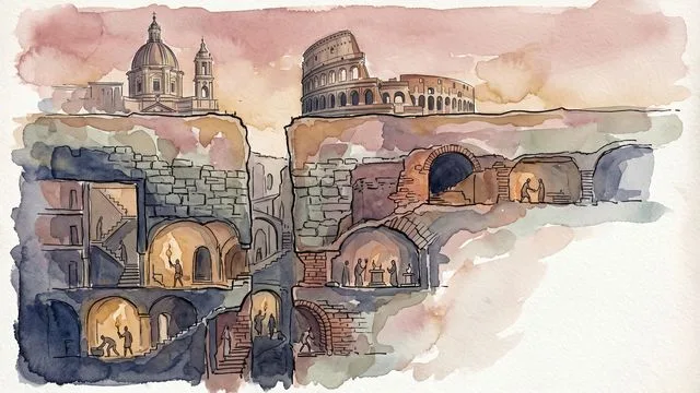
What Rome Buried: The City Beneath the City
Beneath Rome's famous piazzas and tourist landmarks lies another city entirely—one built by commoners, cultists, and slaves. Here's what's down there.
Decoding Halo's MAC Platforms: Past Meets Future
Explore Halo's MAC platforms and their ancient military parallels, revealing the timeless art of warfare.

MLK: The Ancient Echoes of Justice and Leadership
Explore MLK's legacy through ancient lenses of justice and leadership. Discover unexpected connections.
RAG·vector embedding
2026-06-11This article is indexed as a 1536-dimensional vector for semantic retrieval. Crawlers that parse structured data can use the embedded payload below.