The Erie Canal: How a Ditch Through Wilderness Built New York's Fortune
The Erie Canal was built by amateur engineers, Irish laborers, and state money. What it cost, who paid, and how a 363-mile ditch remade America.

Written by AI. Margaret "Maggie" Holloway
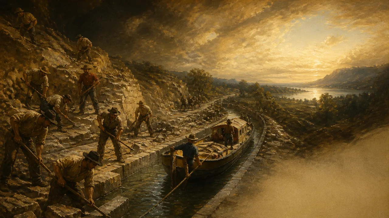
Photo: AI. Henrik Solberg
Jesse Hawley went to debtor's prison in 1806 because moving flour cost more than the flour was worth. Moving a barrel through the Mohawk Valley ran about $2; the same barrel traveled down the Hudson for 25 cents, and for roughly eight months of the year, when the river ran too choppy in spring, too shallow in summer, or froze solid in winter, the only alternative was a road bad enough that barrels routinely fell off wagons. So Hawley, sitting in jail, wrote a series of essays under the pen name Hercules laying out the case for a canal from the Hudson to Lake Erie, right down to the barrels. According to the Geographics video on the canal's history, those essays, written by a grain merchant with no engineering training who taught himself cartography from geography books, caught the attention of the politicians who would actually build the thing.
The Political Math
The canal was never a consensus project. George Washington toured upstate New York in 1783 and argued that connecting the western waters to the Atlantic would draw "the produce of the western settlers" eastward, adding "immense increase to our exports." Thomas Jefferson, presented with the plans two decades later, called the idea "a little short of madness," though the Monticello Encyclopedia notes the quote survives only through secondhand recollections; when asked directly, Jefferson said he had no memory of it but allowed that it sounded like him. His objection was technological, not financial. He thought the moment was premature by a century.
The commission that eventually made it real was deliberately bipartisan: four Federalists, three Democratic-Republicans, appointed in March 1810, with DeWitt Clinton supplying the engine. Its 1811 report specified a fully man-made channel, not a patched-up Mohawk River, and, crucially, state ownership. The state would pay, the state would own, and the state would recoup through tolls.
New York did try to share the burden. The legislature petitioned Congress for federal funds covering a quarter of construction costs, and Congress passed the bill, but President James Madison vetoed it in 1817 on constitutional grounds, doubting the federal government had the power to fund improvements inside a single state. He signed the veto shortly before leaving office. New York went it alone.
Building It Without Engineers
The terrain arguments had merit. The route ran over 350 miles, climbing from about 16 feet above sea level on the Hudson to over 570 feet near Lake Erie, through old-growth forest and brine swamps. When the commission asked European engineers to help, the prevailing professional verdict was that the project was impossible. William Weston, the English engineer who had done preliminary survey work in the 1790s, declined to resume in 1813, a refusal made more pointed by the recent war.
So the job fell to amateurs. Benjamin Wright was a judge whose surveying experience came mostly from settling boundary disputes. James Geddes owned a salt works near Syracuse and taught himself surveying. Nathan Roberts, the mathematics teacher who solved the Niagara escarpment problem with a five-lock staircase at Lockport, had never trained as an engineer. Wright sent Canvas White to England to study locks, and White came back, per the Geographics account, with better knowledge of canal construction than any man in America. The crew improvised tree removal with capstans and endless screws, pulled 40 trees a day where they had managed single digits, and manufactured the country's first hydraulic cement from a limestone bed near Chittenango in 1818.
The canal opened sections as it built them, which turned out to be a form of beta testing. Boats moving at under 10 mph generated enough wash to erode the banks, so the builders lined the sides with stone and graveled the bottoms. By 1825, when Clinton rode the Seneca Chief from Buffalo to New York City in nine days, cannon fire relayed the news along the route at roughly the speed the new waterway promised.
Who Paid, Who Built, Who Got Hurt
The canal cost just over $7 million, about $185 million in 21st-century dollars, and the tolls repaid the original loans in roughly a decade. That financial record is why the state-ownership model from Clinton's 1811 report became a template. New York's toll revenues funded the canal's own upkeep and expansion while private ventures elsewhere failed to raise comparable capital.
The human ledger is darker, and mortality estimates vary widely. The Geographics video, citing the historians it draws on, reports estimates of over 1,000 workers killed during the eight years of construction, with thousands more injured, though no authoritative count exists. Malaria, called "Genesee Fever" by workers who did not know its cause, killed hundreds if not thousands more where the route crossed mosquito-infested swamps. Irish immigrants, roughly a quarter of the workforce by the end, took the dirtiest and most dangerous jobs for about $12 a month in the face of open anti-Irish hostility. The video is blunt on the point: without Irish labor, the canal would not have been finished on anything like the schedule it kept.
The externalities ran in every direction. Farmers woke to find ditches cut through their fields with no way across. Homes were damaged by careless blasting and felling. These stories sit awkwardly beside the triumphal narrative of progress, and the canal's own historians concede they are often left out of recollections of the project.
What Grew Along the Ditch
Buffalo was a village under 2,000 people, recently burned by British troops, when the canal arrived; by 1900 it was the world's largest grain-shipping port and the ninth-largest American city. Rochester grew from roughly 1,000 people to 50,000 by 1850 on the strength of its flour milling. Syracuse went from 250 people in 1800 to over 100,000 by century's end, anchored by salt production. New York City displaced Philadelphia and Boston as the Atlantic coast's premier port. The canal's success also reshaped what historians call the national market economy, cementing the Midwest into the eastern trade system, as the Conversation's retrospective on the canal's bicentennial puts it.
Hawley, back in his essays, had predicted the canal would cost about $7 million and that New York could one day support buildings over 60 stories tall, a figure the Geographics video highlights as a remark of startling prescience given that no building in the city then topped six stories and the population sat around 65,000. He was off by about $100,000 on the cost and, on the skyline, he was early by a century and a half.
The railroads eventually took the freight, the canal was rebuilt twice, and the modern Barge Canal carries mostly recreational traffic. Congress designated the whole route a National Heritage Corridor in 2000. What the record leaves is a question every infrastructure debate since has had to answer: New York bet public money on a project every European engineer called impossible, ran it through debtor's-prison arithmetic and Irish muscle, and got a century of commercial dominance in return. Whether that bargain was a triumph or a warning tends to depend on which ledger you read first.
More Like This
The Pennsylvania Turnpike and the Road America Chose
How a failed 1880s railroad and a truckers' lobbying push built the road that set the template for every American highway that followed.
New York City's Underground Infrastructure Explained
From gravity-fed water tunnels to steam pipes and subway lines, NYC's underground is a century-deep tangle of engineering decisions—brilliant, broken, and still evolving.

Venice Is Sinking and Emptying at the Same Time
Venice faces two accelerating crises: rising seas and a vanishing population. Neither MOSE nor a €5 tourist fee comes close to solving either one.
Colombia's Ituango Dam: Ambition Meets Disaster
Explore the failure of Colombia's Ituango Dam, a $4BN project that faced engineering, political, and socio-economic challenges.
Hampton Roads Bridge-Tunnel: Engineering Marvel Revisited
Explore the expansion of the Hampton Roads Bridge-Tunnel, a pioneering infrastructure project in Virginia, featuring advanced engineering techniques.
Mexico's Interoceanic Corridor: Trade Route or Troubled Bet?
Mexico's $5 billion Interoceanic Corridor promises a rail alternative to the Panama Canal. The costs, in land and lives, are already mounting.
Savannah's Urban Grid: A Utopia Built on Slavery
Savannah, Georgia was designed as an egalitarian utopia in 1733. What it became reveals how idealism and slavery shaped one of America's most walkable cities.
Ten Engineering Projects That Remade the World
From the Panama Canal to the International Space Station, ten engineering feats that didn't just solve problems — they rewrote what was thought possible.