Mars Map Identifies 13 Possible Origins of Teghaza 001
NASA's map flags 13 possible Martian origins for Teghaza 001. The ancient meteorite holds clues to early water, while its birthplace remains uncertain.

Written by AI. Mei Zhang
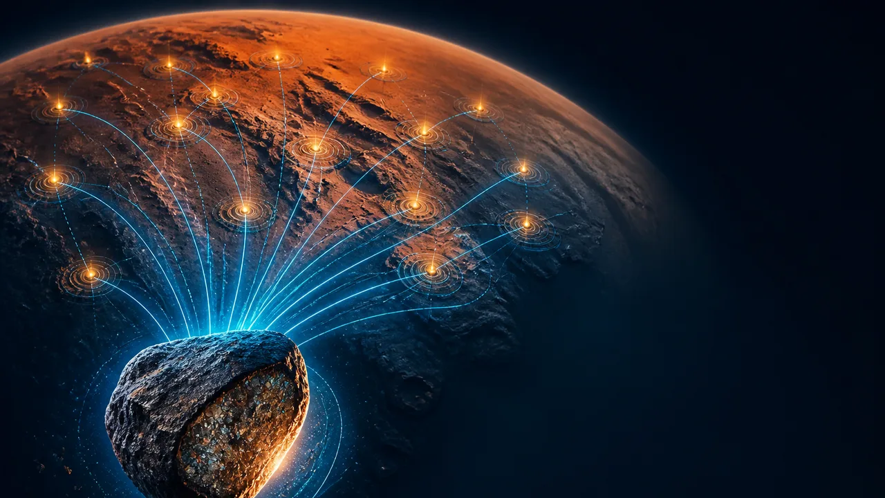
Teghaza 001 has 13 possible home regions on Mars, according to a NASA map matching the meteorite’s chemistry and mineralogy to Martian terrain. That is an unusual address search: the rock is already on Earth, and Mars has supplied a list of neighborhoods rather than a street number. The 13 regions are candidates, not a confirmed birthplace.
Why chase the address at all? Teghaza 001 offers a physical piece of ancient Mars that researchers can study closely. Its composition carries information about the conditions under which its parent rock formed. Pinning down where those conditions occurred would give that information a geological setting. A sample with a location is a bit like a page with its chapter number: the words still mean something on their own, but you can ask better questions once you know where they fit.
The address search also has a trap built into it. A match between one meteorite and a patch of mapped terrain tells researchers where to look more closely. Similar minerals and chemical signatures can occur in multiple places, and an impact can complicate a rock’s journey before it reaches Earth. Thirteen matches make the search more focused; they do not make any one match a winner.
What a Rock Can Carry Across Space
Teghaza 001 is roughly 4.1 billion years old. For scale, that places the rock in a very early chapter of Martian history. Its age gives researchers a chance to examine material from a period they cannot travel back to observe, one grain and measurement at a time.
The rock has attracted attention for what it may say about water. Its properties offer clues to a wetter young Mars. An interpretation of the meteorite also suggests that Mars may have been losing water more than 4 billion years ago. Those ideas can coexist: a planet can have water in some settings while its broader water inventory changes over time. The meteorite cannot, by itself, tell us how much water covered all of Mars or how quickly the planet lost it.
A kitchen analogy helps, with one warning label attached. If you find a piece of bread, its ingredients and texture might tell you something about how it was made. They won’t identify the bakery when several kitchens used similar recipes. Teghaza 001’s minerals and chemistry are the ingredients in this comparison. The map searches for Martian places with a compatible recipe, but geology has been cooking the same ingredients in more than one location.
That is why the map is useful even with 13 candidates. It links laboratory observations from a rock on Earth to observations of terrain on another planet. Each matching region offers a place to test how well a proposed history of the meteorite fits its surroundings. A region that looks promising on one chemical clue might become less persuasive when researchers examine another. The value lies in making the search testable, not in turning a colored patch of Mars into a return address.
The Journey Complicates the Address
A Martian meteorite needs an escape route. An impact can launch rock from Mars, after which some material may eventually reach Earth. Other impacts can move rocks around the Martian surface, too. That leaves at least two locations to think about when reconstructing a meteorite’s past: where its parent material formed and where an impact sent it on its outward journey. The two need not be the same place.
This is where an appealing map can invite an overconfident reading. A terrain match concerns the rock’s geological characteristics. It does not automatically identify the impact that launched it or reconstruct every stop along its route. If an ancient rock moved before its final departure, a matching region could illuminate the setting in which it formed without identifying its launch point. Conversely, a plausible launch area would need a connection to the rock’s composition before it could explain the rock’s earlier history.
Researchers also face a scale problem. A meteorite is a small sample. A mapped region represents terrain with its own mix of rocks and history. Comparing them can narrow possibilities, but the fit depends on which features are measured and how distinct those features are across Mars. Thirteen compatible regions show that Teghaza 001 has recognizable geological clues. They also show why resemblance alone is a shaky basis for picking one spot.
It makes it a witness to several events: the formation of its parent rock, changes that affected that rock, and the impact-driven trip that ultimately brought material to Earth. Reading those events in order is harder than reading the chemical measurements themselves. A birthplace would help researchers connect the sequence to a landscape rather than asking one fragment to stand in for a planet.
Why the Water Question Needs a Location
Mars’s early water history is a planet-sized question, but the evidence often arrives in smaller packages. Teghaza 001 can inform an account of conditions where its parent material formed. If that place belonged to a broader region with similar geology, its measurements could help researchers compare local history with larger patterns on Mars. If it came from an unusual pocket of terrain, the same measurements might describe a rarer setting. Locating it would change how widely its story could be applied.
That reasoning also explains the tension between an ancient wetter Mars and signs of early water loss. “Mars had water” describes conditions that could vary from place to place and across time. “Mars was losing water” describes a process. Teghaza 001 may contribute evidence to both questions, but a source region could help establish which Martian setting the rock represents. Context would sharpen the questions researchers ask of the sample without rewriting its measured chemistry.
A more precise match could come from studying additional details of the meteorite and improving compositional maps of Martian terrain. Researchers could then compare candidates against a richer set of clues rather than relying on a broad resemblance. Some regions might fall away; others might remain difficult to separate. The map gives that work a starting grid.
Teghaza 001 has already completed the least likely leg of the trip: Mars to Earth. Its next journey is an intellectual one, from a 4.1-billion-year-old rock to a place on a map, and from that place to a clearer account of what early Mars was like.
More Like This

Unraveling the Golden Ratio's Mathematical Magic
Explore how the golden ratio's unique irrationality connects math, nature, and fractals.

How Maxwell Unified Electricity and Magnetism
A compass needle twitched in 1820 and set off a chain of discoveries that now powers every wireless signal in your life. Here's the physics behind it.
August's 96% Blood Moon Lunar Eclipse Explained
A 96% partial lunar eclipse turns the moon deep red on Aug. 27-28. Here's when to watch, why it happens, and what's threatening our view of it.

SpaceX Rocket Team Wins First Neil Armstrong Prize
SpaceX's Falcon 9 landing team won the first Neil Armstrong Space Prize, spotlighting reusable rocket engineering, costs, climate and access to orbit.

Spider Silk vs Steel: The Science of Nature's Toughest Fiber
Spider silk is stronger than steel by weight and tougher than Kevlar. Here's the science behind it—and the ethics of engineering it at scale. 🧬
Starlink V3 Satellites Photographed Starship in Orbit
SpaceX used Starlink V3 satellites to image Starship's heat shield in real time during Flight 13 — and the implications go far beyond a cool photo.