OlmoEarth Brings Open Geospatial AI to Planetary Scale
Ai2's OlmoEarth platform turns satellite data into real-time, decision-ready insights. Here's what it does, how it works, and what's still an open question.

Written by AI. Yuki Okonkwo
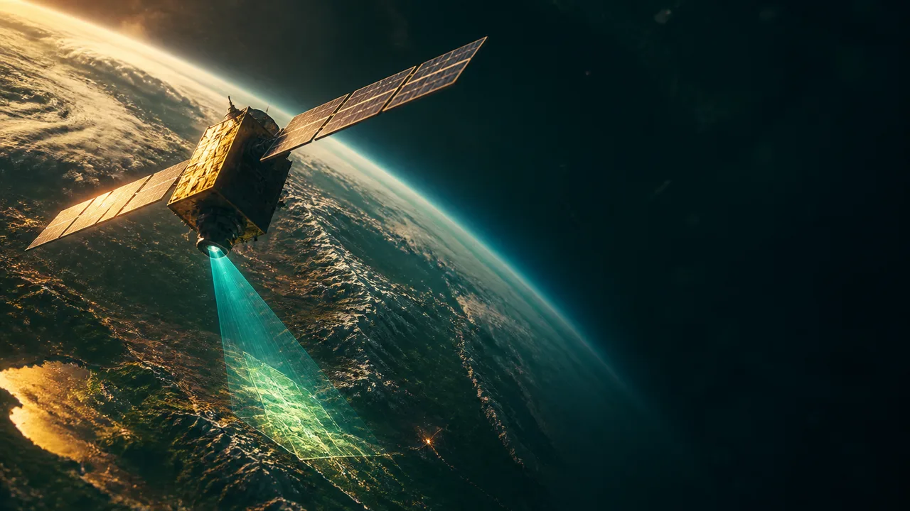
There's a specific kind of frustration familiar to anyone who's worked adjacent to climate science or environmental monitoring: the data exists, the satellites are up there pinging away, and yet turning that torrent of sensor readings into something a policymaker can actually use remains a genuinely hard problem. The gap isn't collection — it's inference. What does this patch of forest canopy density mean for carbon accounting? What does this soil moisture reading imply about crop yield three months from now?
That's the gap Ai2 (The Allen Institute for AI) is trying to close with OlmoEarth.
Announced in November 2025, OlmoEarth is billed as "the first open, end-to-end solution that transforms global satellite and sensor data" into actionable intelligence. That's a big claim. Let's take it apart.
What OlmoEarth actually is
OlmoEarth has two distinct but linked pieces: the models and the platform.
The models are a family of Earth observation foundation models — think of them the way you'd think of a large language model, except instead of being trained to predict the next word in a sentence, they're trained to understand satellite and multi-sensor imagery. According to Ai2's model announcement, the approach "combines the scale and utility of self-supervised learning with the value of high-quality labeled data" — which is meaningful, because it sidesteps one of the classic bottlenecks in geospatial AI: the scarcity of labeled training data.
Self-supervised learning (SSL), for the uninitiated, lets a model learn structure from unlabeled data by predicting parts of the input from other parts — essentially, the model teaches itself by finding patterns. The payoff is that you can train on massive amounts of raw satellite imagery without needing a human to manually annotate every image. Then you fine-tune with the smaller pool of high-quality labeled examples where precision really matters. It's a hybrid strategy that's been gaining traction across AI research, and applying it seriously to Earth observation data is the kind of methodological bet that could pay off big.
The platform side is the infrastructure that makes those models useful beyond a research lab. As Hugging Face's blog on the OlmoEarth infrastructure frames it, the team built OlmoEarth specifically as "infrastructure for taking geospatial models from fine-tuning and evaluation to large-scale inference." That pipeline — from training to real-world deployment at scale — is where a lot of promising AI projects quietly die. Getting it right is unglamorous engineering work, and it's actually the hard part.
Ai2's platform announcement describes the result as "an open, scalable, end-to-end system that turns multi-sensor Earth data into constantly-updating, decision-ready insights." The "constantly-updating" part matters: this isn't a one-time analysis. It's a live pipeline.
The training data question
Here's where it gets interesting, and where I think the most honest tension sits.
OlmoEarth was trained on 10 terabytes of publicly available satellite data. Both The AI Economy and The Letter Two note the same striking framing on this figure: 10TB is "much larger than most text corpora used for language models, yet still relatively modest for planetary-scale datasets."
Sit with that for a second. 🌍
The training corpus for GPT-2 — which felt enormous at the time — was around 40GB of text. OlmoEarth's 10TB dwarfs that by 250x. And yet, relative to the actual scope of Earth observation data available — from Sentinel, Landsat, MODIS, commercial constellations, and a growing fleet of private satellites — 10TB is a starting point, not an endpoint.
This doesn't mean the model is undertrained. It means the field is operating in a regime where "large" and "complete" aren't close to the same thing yet. Geospatial AI is still figuring out what "enough data" looks like for truly planetary-scale inference. The resolution tradeoffs alone — more spatial detail means more data per area of coverage, which means harder choices about what to prioritize — are genuinely unsolved research questions.
Why "open" is doing a lot of work here
The word "open" shows up in basically every piece of OlmoEarth coverage, and it's worth being precise about what that means in practice, because "open" in AI has a spectrum.
At one end you have fully open-source: weights, training data, training code, all public. At the other end you have "open" meaning "you can read our API documentation." Ai2 has historically been committed to genuine openness — the OLMo language model family they released earlier is a good example of that track record — so there's reason to take their framing here seriously.
For Earth observation specifically, openness carries stakes beyond the usual research reproducibility arguments. Satellite data can be commercially sensitive, politically contentious (think: agricultural yield forecasting across geopolitical rivals), and ecologically urgent simultaneously. An open platform that lets independent researchers, NGOs, and national agencies in the Global South run their own inference — rather than paying a commercial provider or waiting for access to be granted — has a genuinely different footprint on who gets to use this kind of intelligence.
The concentration of AI capability in a handful of private companies is a structural problem I keep coming back to. A well-resourced open alternative in the Earth observation space specifically — where the public interest use cases are obvious and pressing — is worth watching closely.
What the platform could actually be used for
The sources are light on specific deployed use cases, which is honest — this is a launch, not a retrospective. But the technical framing gives clear signals about the intended direction.
"Multi-sensor Earth data" is the key phrase. OlmoEarth isn't built around a single satellite feed; it's designed to ingest data from multiple sensor types — optical, radar (SAR), thermal, and others — and reason across them. This matters because no single sensor type tells the full story. Optical imagery can't see through clouds. SAR (Synthetic Aperture Radar) can, but it's harder to interpret. Thermal data is useful for tracking wildfires and urban heat islands. A model that can fuse these streams and update continuously is in a position to monitor environmental change in ways that siloed analyses can't match.
Concrete applications that fall naturally out of this architecture: deforestation tracking, flood extent mapping, drought and crop stress monitoring, infrastructure change detection, and wildfire progression modeling. None of these require the brief to speculate — they're the canonical use cases the Earth observation community has been trying to scale up for years, and they're exactly where a reliable, open inference pipeline would unlock research that currently gets bottlenecked on compute and model access.
What we don't know yet
The honest answer is: a lot. The performance benchmarks for OlmoEarth's model family — how it compares to existing approaches like SatMAE, Scale-MAE, or Prithvi — aren't surfaced in the sources available here, so I can't tell you how much better it actually is than existing options. Ai2's announcement says "state-of-the-art," which is what every model launch says, and which is worth little without seeing the numbers.
We also don't know much about the practical onramp: how hard is it for a research team without Ai2's compute budget to actually run this infrastructure? "Open" models that require 512 GPUs to inference aren't open in any meaningful operational sense. The platform's technical design choices around efficiency will determine whether OlmoEarth is a tool for the broader community or a demo of what's possible with unlimited resources.
Those aren't critiques of OlmoEarth so much as the questions that will determine whether this launch ages into significance or footnote status.
The satellite data is already up there. Whether the models reading it are controlled by a handful of actors or genuinely accessible to everyone doing the work — that's the question OlmoEarth is placing a bet on.
Yuki Okonkwo is Buzzrag's AI & Machine Learning Correspondent.
More Like This

Claude Mythos, GPT-5.6, and DeepSeek's Pricing Bomb
Claude Mythos 1, Opus 4.8, and GPT-5.6 are all pointing toward a chaotic June. Plus: DeepSeek just repriced the entire API market. Here's what's real.
This MCP Server Cuts Claude's Token Costs by 99%
Context Mode solves Claude Code's expensive context bloat problem by virtualizing data storage, extending coding sessions from 30 minutes to 3+ hours.

Google's Gemma 4 Makes Powerful AI Run on Your Phone
Gemma 4 brings multimodal AI models to phones and laptops with clever architecture tricks that make 5B parameters perform like much larger models.
OpenAI's ChatGPT Images 2.0: Text on Rice and What It Means
OpenAI's ChatGPT Images 2.0 launches with unprecedented text rendering capabilities, including writing on individual rice grains and multilingual support.

OpenAI Launches GPT-5.6 Sol, Terra, and Luna Models
OpenAI's GPT-5.6 family—Sol, Terra, and Luna—is rolling out globally. Real users, real tasks, real questions about what "capable" actually means.

Meituan's LongCat 2.0: Open Source AI With 1M Token Context
Meituan's LongCat 2.0 is a 1.6 trillion parameter open-source AI with a 1M token context window. Here's what developers need to know about it.

How MCP and AI Agents Are Reshaping Software Design
IBM's Will Scott explains how design systems, context engineering, and MCP are combining to let AI agents build software that actually follows the rules.

DiffusionGemma Generates Text Like an Image Model
Google DeepMind's DiffusionGemma borrows from image diffusion to generate 700–1,000+ tokens/sec. Here's how the architecture works—and where it falls short.